Seaham, New South Wales
|
Seaham New South Wales |
|||||||||||||||
|---|---|---|---|---|---|---|---|---|---|---|---|---|---|---|---|

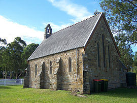
St. Andrews Anglican Church, dedicated 1860
|
|||||||||||||||
| Coordinates | 32°39′54″S 151°43′04″E / 32.66500°S 151.71778°ECoordinates: 32°39′54″S 151°43′04″E / 32.66500°S 151.71778°E | ||||||||||||||
| Population | 1,025 (2011 census) | ||||||||||||||
| • Density | 23.9/km2 (62/sq mi) | ||||||||||||||
| Established | 1822 | ||||||||||||||
| Postcode(s) | 2324 | ||||||||||||||
| Area | 42.8 km2 (16.5 sq mi) | ||||||||||||||
| Time zone | AEST (UTC+10) | ||||||||||||||
| • Summer (DST) | AEDT (UTC+11) | ||||||||||||||
| Location |
|
||||||||||||||
| LGA(s) | Port Stephens Council | ||||||||||||||
| Region | Hunter | ||||||||||||||
| County | Durham | ||||||||||||||
| Parish | Seaham | ||||||||||||||
| State electorate(s) | Port Stephens | ||||||||||||||
| Federal Division(s) | Paterson | ||||||||||||||
|
|||||||||||||||
|
|||||||||||||||
Seaham is a suburb of the Port Stephens local government area in the Hunter Region of New South Wales, Australia. It is located on the Williams River which flows into the Hunter River 14.6 km (9.1 mi) downstream from Seaham village at Raymond Terrace.
It is a rural community supporting a small but expanding population. While the actual village of Seaham, which is located in the north-eastern corner of the suburb, is relatively compact and composed of only a handful of streets, the suburb itself covers an area of approximately 42.8 km2 (16.5 sq mi). At the 2011 census, Seaham had a population of 1,025. Greater Seaham covers an even larger area and incorporates East Seaham, Brandy Hill, Eagleton and Eskdale Estate.
Prior to the arrival of Europeans, the area now known as Seaham was home to the Garewagal clan of the Worimi people.
In 1822, Henry Dangar began surveying the Hunter Valley for settlement. Dangar divided the land into counties and parishes, reserving land for a township where the village of Seaham is now situated. About this time, a military station existed at Seaham in the vicinity of what is now Wighton Street. The village at Seaham was proclaimed in the Government Gazette on 26 July 1838. In the ensuing years, the village became a crossroads between neighbouring centres such as Raymond Terrace and Maitland.
In 1838 Dr Henry Carmichael established a vineyard at "Porphyry Point", north of the village. In the ensuing decades the vineyard proved prosperous, winning numerous awards in Australia and Europe. The last vintage at Porphyry was in 1915, after which the name and trade mark was sold to Lindemans.
...
Wikipedia

