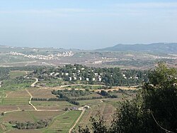
Sasa, Israel
| Sasa | |
|---|---|
 |
|
| Coordinates: 33°1′36.83″N 35°23′40.2″E / 33.0268972°N 35.394500°ECoordinates: 33°1′36.83″N 35°23′40.2″E / 33.0268972°N 35.394500°E | |
| District | Northern |
| Council | Upper Galilee |
| Affiliation | Kibbutz Movement |
| Founded | January 1949 |
| Founded by | Hashomer Hatzair members |
| Population (2015) | 398 |
| Website | www.sasa.org.il |
Sasa (Hebrew: סָאסָא) is a kibbutz in the Upper Galilee area of northern Israel. Located one mile from the border with Lebanon, it falls under the jurisdiction of Upper Galilee Regional Council. In 2015 it had a population of 398.
At the site of Sasa, remains of a settlement from the Bronze Age (early second millennium B.C.) have been unearthed, such as walls, tombs, cisterns, olive and wine presses. One house of the village of Sa'sa' had foundations which has been dated back to the fourth century by archaeologists.
The Arab geographer Abū 'Ubayd 'Abd Allāh al-Bakrī (d.1094) reported that one passed through Sa'sa' when travelling from Dayr al-Qasi to Safad.
An excavation which took place in 2003 yielded ceramics dated to the fourteenth–fifteenth centuries CE.
In 1516 Sa'sa', with the rest of Palestine, came under the control of the Ottoman Empire. Shortly after, Sa'sa' was made a checkpoint where a toll was collected on various goods and travellers; the first records of such taxes are from 1525/6.
In 1596 Sa'sa' was classified as a village in the nahiya ("subdistrict") of Jira, part of liwa' ("district") of Safad, with a population of 457. It paid taxes on wheat, barley, olives and fruits, as well as on goats, beehives, and vineyards. According to this daftar, there were no non-Muslim inhabitants in the village.
...
Wikipedia

