Santa Margalida
| Santa Margalida | ||
|---|---|---|
| Municipality | ||
| Santa Margalida | ||
 |
||
|
||
| Location in Majorca | ||
| Coordinates: 39°42′12″N 3°6′13″E / 39.70333°N 3.10361°ECoordinates: 39°42′12″N 3°6′13″E / 39.70333°N 3.10361°E | ||
| Country |
|
|
| Autonomous community |
|
|
| Province | Balearic Islands | |
| Island | Mallorca | |
| Comarca | Llevant | |
| Judicial district | Inca | |
| Government | ||
| • Alcalde | Antoni Reus Darder (2013) (Independents - coalition Suma pel canvi) | |
| Area | ||
| • Total | 86.51 km2 (33.40 sq mi) | |
| Elevation | 100 m (300 ft) | |
| Population (2009) | ||
| • Total | 11,537 | |
| • Density | 130/km2 (350/sq mi) | |
| Demonym(s) | Margalidà, -ana and their internal variations Viler, -a ; Picaforter, -a ; Sonserramarí, -ina. | |
| Time zone | CET (UTC+1) | |
| • Summer (DST) | CEST (UTC+2) | |
| Official language(s) | Catalan | |
| Website | Official website | |
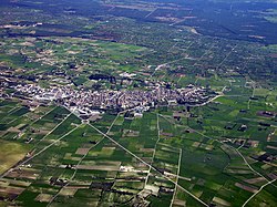
Santa Margalida is a municipality with a population of 10,204 located in the northeast of the Spanish Balearic Island Majorca.
The residents are divided over three settlement areas, the principal one being Santa Margalida, 10 km inland from the coast. The other areas are primarily Tourist resorts, Can Picafort and Son Serra de Marina on the coast at the bay of Alcúdia.
The non-national population stands at 23.6% (2,413).
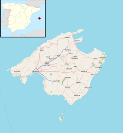
The municipality of Santa Margalida lies about 45 Kilometres from the islands capital Palma. It is part of the region (Comarca) Plà de Mallorca or Es Plà, the great central plain of the island.
The municipality is one of the flattest on Majorca with very little more than 100 metres above sea level. The area is drained by a few streams which flow towards the sea in the north east. In the north west Santa Margalida is bordered by a fresh water swamp. Along the north eastern coast there are obelisks at regular intervals of 1,250m. These, along with corresponding twin towers 200 metres inland were used in the 19th century as navigational points of reference for seafarers.
In the north west Santa Margalida is bordered by Muro and Llubí. Both of which, belong to Es Plà, along with Maria de la Salut, Ariany and Petra to the south. In the east the Torrent de na Borges forms the border to Artà in the Llevant region.
The municipality of Santa Margalida has three towns. The population figures follow date from 1 January 2005 and don't include the population outside these settlements, hence the sum of the figures does not add up to the total population of the municipality (Source: INE).
There is a long tradition of agriculture and handicrafts in the region.
The historically proven founding of a municipality took place soon after the Reconquista. Old inscriptions and tombstones bear witness though of the place being inhabited already in Roman times, then called Hero. Later, during the Arab reign, the great estate of Abenmaaxbar was located here. The location itself and St. Margalida are the topics of many myths and tales which eventually the municipalities namesake.
...
Wikipedia


