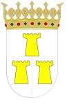
Santa Eulalia del Campo
| Santa Eulalia del Campo | |||
|---|---|---|---|
 |
|||
|
|||
| Coordinates: 40°34′N 1°19′W / 40.567°N 1.317°WCoordinates: 40°34′N 1°19′W / 40.567°N 1.317°W | |||
| Country | Spain | ||
| Autonomous community | Aragon | ||
| Province | Teruel | ||
| Municipality | Santa Eulalia del Campo | ||
| Government | |||
| • Mayor | Héctor Palatsi Martínez | ||
| Area | |||
| • Total | 80.9 km2 (31.2 sq mi) | ||
| Elevation | 984 m (3,228 ft) | ||
| Population (2005) | |||
| • Total | 1,171 | ||
| Time zone | CET (UTC+1) | ||
| • Summer (DST) | CEST (UTC+2) | ||
Santa Eulalia del Campo is a municipality located in the province of Teruel, Aragon, Spain. According to the 2005 census (INE), the municipality has a population of 1,171 inhabitants.
This town is located near Sierra Palomera, a mountain range of the Sistema Ibérico.
The surroundings of the Chapel of the Mill; Sierra Palomera with a view of the former premises of the Sugar Factory; Jiloca; the Media Caseta Mount or Mount Cirogrillos; Railway Station Via Minero Peirón of the Virgen del Pilar - on the road to the Tremedal Orihuela - are some of the tourist attractions.
...
Wikipedia


