Sanders, Arizona
| Sanders, Arizona | |
|---|---|
| Census-designated place | |

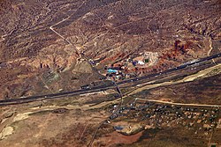
Sanders and I-40 from the air
|
|
| Coordinates: 35°12′59″N 109°20′01″W / 35.21639°N 109.33361°WCoordinates: 35°12′59″N 109°20′01″W / 35.21639°N 109.33361°W | |
| Country | United States |
| State | Arizona |
| County | Apache |
| Area | |
| • Total | 2.4 sq mi (6.2 km2) |
| • Land | 2.4 sq mi (6.2 km2) |
| • Water | 0.0 sq mi (0.0 km2) |
| Elevation | 5,865 ft (1,788 m) |
| Population (2010) | |
| • Total | 630 |
| • Density | 263/sq mi (101.6/km2) |
| Time zone | MST (UTC-7) |
| • Summer (DST) | MDT (UTC-6) |
| ZIP code | 86512 |
| FIPS code | 04-63050 |
| GNIS feature ID | 0010911 |
Sanders (Navajo: Łichííʼ Deezʼáhí) is an unincorporated community and census-designated place (CDP) in Apache County, Arizona, United States. Sanders is located at the junction of U.S. Route 191 and Interstate 40. As of the 2010 census, it had a population of 630.
Sanders has the ZIP code 86512.
Sanders' English name either comes from C.W. Sanders, a railroad office engineer, or Art Saunders, who had a trading post nearby. The railroad station was named Cheto to avoid confusion with another station named Sanders already on the line.
Sanders is located near Interstate 40 and the BNSF Railway. Old Route 66 ran near the town and some sections of the highway still exist. Sanders is surrounded by the Nahata Dziil and (north of the town) Houck chapters of the Navajo Nation. The latter is made up of local Navajos of the area and relocated Navajo refugees from the Navajo/Hopi land dispute. That dispute relocated hundreds of Navajos to the Sanders area from the western Navajo Nation, mainly around the Hopi partitioned land. The area was mostly ranch land until the U.S. government bought it and added it to the Navajo Nation in 1981.
Sanders is located at 35°12′59″N 109°20′01″W / 35.21639°N 109.33361°W (35.21649, -109.33366), at Exit 339 on Interstate 40. By I-40 it is 6 miles (10 km) west to Chambers, 53 miles (85 km) west to Holbrook, and 44 miles (71 km) east to Gallup, New Mexico. U.S. Route 191 leads south 54 miles (87 km) to St. Johns.
...
Wikipedia

