Saarlouis (district)
| Saarlouis | |
|---|---|
| District | |
 |
|
| Country |
|
| State | Saarland |
| Capital | Saarlouis |
| Area | |
| • Total | 459.08 km2 (177.25 sq mi) |
| Population (31 December 2015) | |
| • Total | 197,009 |
| • Density | 430/km2 (1,100/sq mi) |
| Time zone | CET (UTC+1) |
| • Summer (DST) | CEST (UTC+2) |
| Vehicle registration | SLS (since 1957) OE 6/ OE 16/ OE 26/ OE 36 (1949–1956); SA 06 (1945–1949) |
| Website | kreis-saarlouis.de |
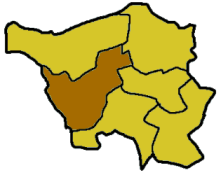
Saarlouis (Sarrelouis in French) is a Kreis (district) in the middle of the Saarland, Germany. Neighboring districts are Merzig-Wadern, Sankt Wendel, Neunkirchen, Saarbrücken, and the French département Moselle.
The district was part of the Holy Roman Empire of the German nation. The biggest part of the district was part of duchy of Lorraine which gradually came under French sovereignty (still as a part of the holy empire) between 1737 and 1766. Other villages were part of the county of Nassau-Saarbrücken. The territory of the city Saarlouis which was built to protect the border, came to France as part of the three Bishoprics. Other villages, which today are considered to be too small to form villages of their own were independent imperial territories. The district showed the fundamental problem of the whole empire: A strong influence of foreign rulers and mircro-sized territories. After the Napoleonic wars the area went to Prussia, which in 1816 created the district as part of its Rhineland province. Between 1936 and 1945 it was called Saarlautern, when the Nazi government attempted to conceal the name's French origin.
The main river in the district is the Saar.
Coordinates: 49°20′N 6°45′E / 49.33°N 6.75°E
...
Wikipedia
