São João da Pesqueira
| São João da Pesqueira | |||
|---|---|---|---|
| Municipality | |||
 |
|||
|
|||
 |
|||
| Coordinates: 41°08′N 7°24′W / 41.133°N 7.400°WCoordinates: 41°08′N 7°24′W / 41.133°N 7.400°W | |||
| Country |
|
||
| Region | Norte | ||
| Subregion | Douro | ||
| Intermunic. comm. | Douro | ||
| District | Viseu | ||
| Parishes | 11 | ||
| Government | |||
| • President | António Lima Costa (PSD) | ||
| Area | |||
| • Total | 266.11 km2 (102.75 sq mi) | ||
| Population (2011) | |||
| • Total | 7,874 | ||
| • Density | 30/km2 (77/sq mi) | ||
| Time zone | WET/WEST (UTC+0/+1) | ||
| Website | http://www.cm-sjpesqueira.espigueiro.pt | ||
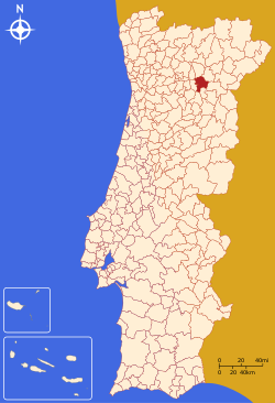
São João da Pesqueira (Portuguese pronunciation: [sɐ̃w ʒuˈɐ̃w dɐ pɨʃˈkɐjɾɐ]) is a municipality and municipal seat in the Portuguese district of Viseu. The population of the municipality in 2011 was approximately 7,874 inhabitants, in an area that extends 266.11 square kilometres (102.75 sq mi). The present mayor is António Lima Costa, elected by the Social Democratic Party. The municipal holiday is June 24.
São João da Pesqueira is the oldest recognized municipality in the country, created in 1055, thus taking precedence over such major cities as Coimbra, Guimarães or Lamego.
The municipality is situated at 850 metres (2,790 ft) above sea level and is bordered on the north by the River Douro and the municipality of Alijó, on the northeast by Carrazeda de Ansiães, on the east by Vila Nova de Foz Côa (district of Guarda), on the south-east by Penedono, on the south by Sernancelhe, on the west by Tabuaço and on the north-west by Sabrosa. The municipality includes an attractive countryside with viewpoints over the Douro valley and the Valeira dam from the chapel of São Salvador do Mundo (Ermo).
Administratively, the municipality is divided into 11 civil parishes:
Situated in the heart of the Douro wine region, São João da Pesqueira is well endowed with vineyards that support the production of vintage and port wines.
...
Wikipedia


