Carrazeda de Ansiães
| Carrazeda de Ansiães | |||
|---|---|---|---|
| Municipality | |||
|
|||
 |
|||
| Coordinates: 41°14′33″N 7°18′21″W / 41.24250°N 7.30583°WCoordinates: 41°14′33″N 7°18′21″W / 41.24250°N 7.30583°W | |||
| Country |
|
||
| Region | Norte | ||
| Subregion | Douro | ||
| Intermunic. comm. | Douro | ||
| District | Bragança | ||
| Parishes | 14 | ||
| Government | |||
| • President | José Luís Correia (PS) | ||
| Area | |||
| • Total | 279.24 km2 (107.82 sq mi) | ||
| Elevation | 770 m (2,530 ft) | ||
| Population (2011) | |||
| • Total | 6,373 | ||
| • Density | 23/km2 (59/sq mi) | ||
| Time zone | WET/WEST (UTC+0/+1) | ||
| Postal code | 5140 | ||
| Area code | 278 | ||
| Patron | Santa Maria Maior | ||
| Website | http://www.cm-carrazedadeansiaes.pt | ||
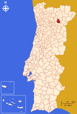
Carrazeda de Ansiães (Portuguese pronunciation: [kɐʁɐˈzeðɐ ðɨ ɐ̃siˈɐ̃jʃ]) is a municipality in the district of Bragança in northern Portugal. The population in 2011 was 6,373, in an area of 279.24 km².
The territory began its historical journey, from ancient vestiges discovered, during the Neolithic period, from dolmens from Zedes and Vilarinho da Castanheira. This structures were both monumental and served to support the hunter-gathering cultures. The local dolmen were discovered with paintings, consisting of circular and spiral patterns, in addition to ceramics with undulating painted lines. Vilarinho da Castanheira also shows evidence of the areas importance as a graveyard and burial site: bodies were buried here, surrounded by large rock monuments and objects of the local religion. In Cachão da Rapa, in the shadow of the Douro river, there are similar paintings of dark red and blues, that include anthropomorphic stylized human beings. The discovery of archeological artifacts, namely lithic flakes of quartz, fragments of metamorphic schist implements, rounded pebbles and machetes, support the belief that indigenous peoples used the space. There are also lithic remnants scattered throughout the municipality with many symbols (arcs, circles or semi-circles). In the Chalcolithic and Iron Age, settlements were common in the region of Carrazed de Ansiães: places such as Castro, Lapa, Serro and Castelo Fontoura, indicate the exists of organized settlement during these periods.
The Romans also reorganized the territory; in the Roman villa in Quinta da Senhora da Ribeira (in Tralhariz), there were discovered vestiges of the construction of a sumptuous residence, completed with polychromatic tile, colonaded interiors and carved relief. During this era Ansiães was a Roman city, designated Aquas Quintianas. The town had three altars dedicated to the local protector Tutelae Tiriensi, the other to Bandu Vordeaeco (to the cult of Lusitania in Seixo de Ansiães) and lastly to Jupiter Optimum Máximo (English: Supreme God) in Pombal. There are also visible remains of the Roman roads, including a variant of the Roman road that connect Braga and Chave, over many Roman era bridges, such as Ponte das Olgas (Pereiros) and Ponte do Torno (Amedo). The Roman era reached its end with barbarian invasions, the Suebi controlling the territory with their administrative seat in Pagus Auneco, which ultimately led to the growing influence of the walled settlement of Ansiães.
...
Wikipedia


