Roraima
| State of Roraima | |||
|---|---|---|---|
| State | |||
|
|||
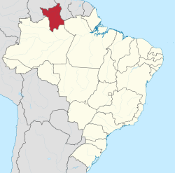
 Location of State of Roraima in Brazil |
|||
| Coordinates: 2°3′N 61°24′W / 2.050°N 61.400°WCoordinates: 2°3′N 61°24′W / 2.050°N 61.400°W | |||
| Country |
|
||
| Capital and Largest City | Boa Vista | ||
| Government | |||
| • Governor | Suely Campos | ||
| • Vice Governor | Paulo Quartiero | ||
| Area | |||
| • Total | 224,298.98 km2 (86,602.32 sq mi) | ||
| Area rank | 14th | ||
| Population (2012) | |||
| • Total | 469,524 | ||
| • Rank | 27th | ||
| • Density | 2.1/km2 (5.4/sq mi) | ||
| • Density rank | 27th | ||
| Demonym(s) | Roraimense | ||
| GDP | |||
| • Year | 2006 estimate | ||
| • Total | R$ 3,660,000,000 (27th) | ||
| • Per capita | R$ 9,075 (13th) | ||
| HDI | |||
| • Year | 2010 | ||
| • Category | 0.707 – high (13th) | ||
| Time zone | BRT-1 (UTC-4) | ||
| • Summer (DST) | BRST-1 (UTC-3) | ||
| Postal Code | 69300-000 to 69399-000 | ||
| ISO 3166 code | BR-RR | ||
| Website | rr.gov.br | ||
Roraima (Pemon: roro imã, "parrot mountain" i.e. "Green Peak", Portuguese pronunciation: [ʁoˈɾajmɐ]) is the northernmost and least populated state of Brazil, located in the Amazon region. It borders the states of Amazonas and Pará, as well as the nations of Venezuela and Guyana. The population is approximately 450,000 (2010) and the capital is Boa Vista. Roraima is the Brazilian state with the fewest municipalities, 15 in total.
The climate of Roraima is tropical with an annual mean temperature of 26°C (78.8°F). The state's southern part is located in the Amazon rainforest, while the north has open grassland fields, and there is a small strip of savanna to the east. The state is rich in mineral deposits - especially gold, diamonds, cassiterite, bauxite, marble and copper. Many of these deposits are located in indigenous reserves, and illegal mining has resulted in frequent conflicts with the native population, especially the Yanomami and the Macuxi and allied groups.
The Monte Roraima National Park is located around one of the highest mountains of both Venezuela (outside of the Andes) and Brazil, and the highest in Guyana, a 2,875 m (9,432 ft) high tepui known as Monte Roraima. Only a small fraction of the mountain is in Brazilian territory, however, and the highest point of the Brazilian part is at 2,734 metres (8,970 ft).
...
Wikipedia


