Riverside, Illinois
| Riverside, Illinois | |
|---|---|
| Village | |
| Village of Riverside | |

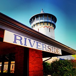
Riverside's Historic Water Tower and Train Station
|
|
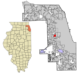
 Location in Cook County and the state of Illinois. |
|
 Location of Illinois in the United States |
|
| Coordinates: 41°49′51″N 87°48′58″W / 41.83083°N 87.81611°WCoordinates: 41°49′51″N 87°48′58″W / 41.83083°N 87.81611°W | |
| Country |
|
| State | Illinois |
| County | Cook |
| Township | Riverside |
| Incorporated | 1875 |
| Government | |
| • Type | Board of Trustees and Village President |
| • President | Benjamin Sells |
| Area | |
| • Total | 2.00 sq mi (5.2 km2) |
| • Land | 1.98 sq mi (5.1 km2) |
| • Water | 0.02 sq mi (0.05 km2) 1.00% |
| Population (2010) | |
| • Total | 8,875 |
| • Density | 4,482.3/sq mi (1,730.6/km2) |
| Down 0.22% from 2000 | |
| Standard of living (2007–11) | |
| • Per capita income | $46,334 |
| • Median home value | $397,200 |
| ZIP code(s) | 60546 |
| Area code(s) | 708 |
| Geocode | 54820 |
| Website | www |
|
Riverside Landscape Architecture District
|
|
| Location | Bounded by 26th St., Harlem and Ogden Aves., the Des Plaines River, and Forbes Rd., Riverside, Illinois |
|---|---|
| Built | 1869 |
| Architect | Frederick Law Olmsted; Calvert Vaux |
| NRHP Reference # | 69000055 |
| Added to NRHP | September 15, 1969 |
 |
|
|
|
Riverside is a suburban village in Cook County, Illinois, United States. A significant portion of the village is in the Riverside Landscape Architecture District, designated a National Historic Landmark in 1970. The population of the village was 8,875 at the 2010 census. It is a suburb of Chicago, located roughly 9 miles (14 km) west of downtown Chicago and 2 miles (3 km) outside city limits.
Riverside is arguably the first planned community in the United States, designed in 1869 by Calvert Vaux and Frederick Law Olmsted. The village was incorporated in 1875. The Riverside Landscape Architecture District, an area bounded by 26th Street, Harlem and Ogden avenues, the Des Plaines River, and Golf Road, was designated a National Historic Landmark in 1970. In 1863 the Chicago, Burlington and Quincy Railroad was built heading southwest from downtown Chicago to Quincy, Illinois, passing through what is now the Near West Suburban area of Chicago in a western-southwestern direction. This new access to transportation and commerce brought about a significant housing and construction boom in what was once farmland far from the bustle of the city of Chicago.
In 1868, an eastern businessman named Emery E. Childs formed the Riverside Improvement Company, and purchased a 1,600-acre (6.5 km2) tract of property along the Des Plaines River and the Chicago, Burlington & Quincy Railroad line. The site was highly desirable due to its natural oak-hickory forest and its proximity to Chicago. The company commissioned well-known landscape architect Frederick Law Olmsted and his partner, Calvert Vaux, to design a rural bedroom community. The town's plan, which was completed in 1869, called for curvilinear streets, following the land's contours and the winding Des Plaines River. The plan also accorded for a central village square, located at the main railroad station, and a Grand Park system that uses several large parks as a foundation, with 41 smaller triangular parks and plazas located at intersections throughout town to provide for additional green spaces.
...
Wikipedia
