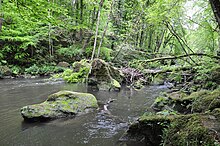
River Prüm
| Prüm |

|
| Location |
Eifel, Vulkaneifel, Bitburg-Prüm, Rhineland-Palatinate, Germany
|
| Reference no. |
DE: 2628 |
| Physical characteristics |
| Main source |
Between Ormont and Reuth on the Schneifelridge
ca. 650 m above sea level (NHN)
50°18′53″N 6°28′8.8″E / 50.31472°N 6.469111°E / 50.31472; 6.469111Coordinates: 50°18′53″N 6°28′8.8″E / 50.31472°N 6.469111°E / 50.31472; 6.469111
|
| River mouth |
in Minden into the Sauer
ca. 154 m above sea level (NHN)
49°49′22″N 6°28′16.1″E / 49.82278°N 6.471139°E / 49.82278; 6.471139
|
| Length |
95.04 km |
| Discharge |
|
| Basin features |
| Progression |
Sauer→ Moselle→ Rhine→ North Sea
|
| Basin size |
888.758 km² |
| Landmarks |
- Small towns: Prüm
- Villages: Neuendorf, Olzheim, Watzerath, Pittenbach, Pronsfeld, Lünebach, Merlscheid, Kinzenburg, Waxweiler, Niederpierscheid, Mauel, Echtershausen, Hamm, Wiersdorf, Wißmannsdorf, Brecht, Oberweis, Bettingen, Wettlingen, Peffingen, Holsthum, Prümzurlay, Irrel, Menningen, Minden
|
| Tributaries |
|
| Waterbodies |
Reservoirs: Bitburg Reservoir
|

|
The Prüm (German pronunciation: [ˈpʁʏm]) is a river in Rhineland-Palatinate, Germany, left tributary of the Sauer. Its total length is 95 km, and its basin area is 889 km². The Prüm rises in the Schneifel hills, north of the town of Prüm, close to the border with Belgium. It flows southward through Prüm, Waxweiler, Holsthum, and Irrel. The Prüm discharges to the Sauer in Minden, on the border with Luxembourg, three kilometres east of Echternach. The largest tributary of the Prüm is the Nims.
The catchment of the Prüm is 888.758 km² in area. Its tributaries include: The largest tributaries of the Prüm are; (l = left bank (dark blue), r = right bank; light blue):
...
Wikipedia


