Richton Park, Illinois
| Village of Richton Park | |
| Village | |
| Motto: "Proud Past; Bright Future" | |
| Country | United States |
|---|---|
| State | Illinois |
| County | Cook |
| Coordinates | 41°28′55″N 87°43′31″W / 41.48194°N 87.72528°WCoordinates: 41°28′55″N 87°43′31″W / 41.48194°N 87.72528°W |
| Area | 3.99 sq mi (10 km2) |
| - land | 3.98 sq mi (10 km2) |
| - water | 0.01 sq mi (0 km2) |
| Population | 13,646 (2010) |
| Density | 3,428.6/sq mi (1,324/km2) |
| Timezone | CST (UTC-6) |
| - summer (DST) | CDT (UTC-5) |
| Postal code | 60471 |
| Area code | 708 |
|
Location in Cook County and the state of Illinois.
|
|
|
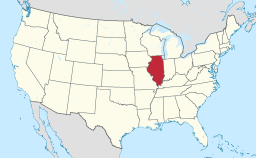
Location of Illinois in the United States
|
|
|
Website: www |
|
Richton Park is a village in Cook County, Illinois, United States. The population was 13,646 at the 2010 census.
Richton Park is located at 41°28′55″N 87°43′31″W / 41.48194°N 87.72528°W (41.481992, -87.725352).
According to the 2010 census, Richton Park has a total area of 3.992 square miles (10.34 km2), of which 3.98 square miles (10.31 km2) (or 99.7%) is land and 0.012 square miles (0.03 km2) (or 0.3%) is water. It is bordered by Matteson to the north, Park Forest to the east, and University Park to the south. Frankfort is the closest neighbor to the west.
As of the 2010 census, there were 13,646 people, 5,391 households, and 2.54 persons living per household. The population density was 3,426.9 people per square mile (1,435.9/km²) according to 2010 census. There were 4,730 housing units at an average density of 1,401.9 per square mile (541.9/km²) in 2000. By 2010, the racial makeup of the village was 82.4% African American, 12.7% White, 0.1% Native American, 1.0% Asian, 0.1% Pacific Islander and 2.6% from two or more races. Hispanic or Latino of any race were 3.5% of the population.
...
Wikipedia


