Rappahannock County
| Rappahannock County, Virginia | ||
|---|---|---|

Rappahannock County Courthouse in Washington, Virginia
|
||
|
||
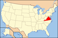
 Location in the U.S. state of Virginia |
||
 Virginia's location in the U.S. |
||
| Founded | 1833 | |
| Named for | Rappahannock River | |
| Seat | Washington | |
| Largest town | Washington | |
| Area | ||
| • Total | 267 sq mi (692 km2) | |
| • Land | 266 sq mi (689 km2) | |
| • Water | 0.8 sq mi (2 km2), 0.3% | |
| Population (est.) | ||
| • (2016) | 7,308 | |
| • Density | 27/sq mi (10/km²) | |
| Congressional district | 5th | |
| Time zone | Eastern: UTC-5/-4 | |
| Website | rappahannockcountyva |
|
Rappahannock County is a county located in the Commonwealth of Virginia, US. As of the 2010 census, the population was 7,373. Its county seat is Washington. The name "Rappahannock" comes from the Algonquian word lappihanne (also noted as toppehannock), meaning "river of quick, rising water" or "where the tide ebbs and flows."
Rappahannock County is included in the Washington-Arlington-Alexandria, DC-VA-MD-WV Metropolitan Statistical Area.
Rappahannock County was founded by an act of the Virginia General Assembly in 1833, based on the growing population's need to have better access to a county seat. The county's land was carved from Culpeper County. Rappahannock county was named for the river that separates it from Fauquier County.
According to the U.S. Census Bureau, the county has a total area of 267.2 square miles (692.0 km2), of which 266.4 sq mi (690.0 km2) is land and 0.8 sq mi (2.1 km2) (0.3%) is water.
The Rappahannock River forms the northeastern boundary and separates Rappahannock County from Fauquier County. Rappahannock County is bounded on the southeast by Culpeper County and on the southwest by Madison County. The Blue Ridge Mountains occupy much of the western portion of the county.
The summits of the following mountains are located within Rappahannock County:
As of the census of 2010, there were 7,373 people, 2,788 households, and 2,004 families residing in the county. The population density was 26 people per square mile (10/km2). There were 3,303 housing units, at an average density of 12 per square mile (5/km²). The racial makeup of the county was 92.64% White, 5.44% Black or African American, 0.16% Native American, 0.21% Asian, 0.40% from other races, and 1.15% from two or more races. 1.30% of the population were Hispanic or Latino of any race.
...
Wikipedia

