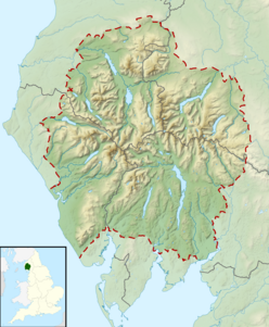
Rannerdale Knotts
| Rannerdale Knotts | |
|---|---|

Rannerdale Knotts (centre right) from Haystacks
|
|
| Highest point | |
| Elevation | 355 m (1,165 ft) |
| Prominence | c. 70 m |
| Parent peak | Crag Hill |
| Listing | Wainwright |
| Coordinates | 54°33′08″N 3°17′22″W / 54.55216°N 3.28941°WCoordinates: 54°33′08″N 3°17′22″W / 54.55216°N 3.28941°W |
| Geography | |
| Location | Cumbria, England |
| Parent range | Lake District, North Western Fells |
| OS grid | NY167182 |
| Topo map | OS Landranger 89, Explorer OL4 |
Rannerdale Knotts is a fell in the Lake District of Cumbria, England. Rising from the Buttermere valley, it is one of the smaller Cumbrian hills and is overlooked by a number of surrounding fells, such as Grasmoor, Whiteless Pike and, across Crummock Water, Mellbreak and the High Stile ridge. Rannerdale Knotts is said to be the site of a battle between the native Cumbrians and Norsemen and the invading Normans in the late 11th or early 12th century.
The North Western Fells occupy the area between the rivers Derwent and Cocker, a broadly oval swathe of hilly country, elongated on a north-south axis. Two roads cross from east to west, dividing the fells into three convenient groups. The central sector, rising between Whinlatter Pass and Newlands Pass, includes Whiteless Pike.
The highest ground in the North Western Fells is an east-west ridge in this central sector, beginning with Grasmoor above Crummock Water and then gradually descending eastwards over Crag Hill, Sail, Scar Crags and Causey Pike. Grasmoor has the greatest elevation, but Crag Hill stands at the hub of the range. It sends out a subsidiary ridge to the south west, stepping down over Wandope and Whiteless Pike toward Buttermere village. Just above the village this ridge then turns sharply north west and rises to the summit of Rannerdale Knotts.
The sharp angle in the ridge is marked by a depression at 950 ft, beyond which the ground climbs slowly for around a mile toward the top. This section of the fell is named Low Bank on Ordnance Survey maps and is clad primarily in bracken. The final section bears a series of rocky knolls, still rising slowly north westward. A tumbling descent of crag and scree then follows as the end of the ridge drops steeply to the valley floor, halfway along the shore of Crummock Water. Rannerdale farm lies below this terminal face.
...
Wikipedia

