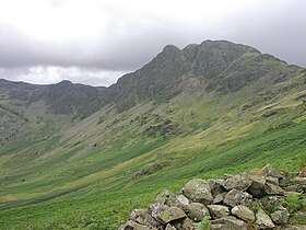
Haystacks (Lake District)
| Haystacks | |
|---|---|
 |
|
| Highest point | |
| Elevation | 597 m (1,959 ft) |
| Prominence | c. 92 m |
| Listing | Wainwright |
| Geography | |
| Location | Cumbria, England |
| Parent range | Lake District, Western Fells |
| OS grid | NY193131 |
| Topo map | OS Landrangers 89, 90, Explorer, OL4 |
Haystacks, or Hay Stacks, is a hill in England's Lake District, situated at the south-eastern end of the Buttermere Valley. Although not of any great elevation (597 m, 1,958 ft), Haystacks has become one of the most popular fells in the area. This fame is partly due to the writings of Alfred Wainwright, who espoused its attractions and chose it as the place where he wanted his ashes scattered. Its summit is interesting and contains a number of attractive rock formations and tarns.
The Western Fells occupy a triangular sector of the Lake District, bordered by the River Cocker to the north east and Wasdale to the south east. Westwards the hills diminish toward the coastal plain of Cumberland. At the central hub of the high country are Great Gable and its satellites, while two principal ridges fan out on either flank of Ennerdale, the western fells in effect being a great horseshoe around this long wild valley. Although lower than its neighbours, Haystacks provides the connection between the Great Gable group and the northern branch of the horseshoe. Immediately to the south east are Brandreth, Green Gable and Great Gable, forming the head of Ennerdale. North west are the well known trio of Buttermere fells, High Crag, High Stile and Red Pike.
The Buttermere- Ennerdale watershed descending from Brandreth is initially indistinct, running north west across a broad plateau. After half a mile it reaches the rocky protuberance of Great Round How (1,817 ft) and then its character changes completely. The watershed narrows to fine ridge, steep enough on the Ennerdale side and rimmed by crags throughout above the head of Buttermere. The beauty of the scene is completed by a succession of rocky tops and nestling tarns, until the high point is reached at the western end. A sharp descent over rock now follows, leading to Scarth Gap (1,460 ft), a walkers' pass between the two valleys. Beyond the ridge rises again to High Crag, a steep climb on scree.
...
Wikipedia
