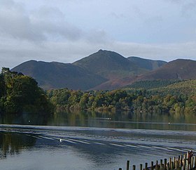
Causey Pike
| Causey Pike | |
|---|---|

seen from Derwentwater |
|
| Highest point | |
| Elevation | 637 m (2,090 ft) |
| Prominence | 40 m (130 ft) |
| Parent peak | Scar Crags |
| Listing | Hewitt, Nuttall, Wainwright |
| Coordinates | 54°34′35″N 3°12′41″W / 54.57634°N 3.21127°WCoordinates: 54°34′35″N 3°12′41″W / 54.57634°N 3.21127°W |
| Geography | |
| Location | Cumbria, England |
| Parent range | Lake District, North Western Fells |
| OS grid | NY218208 |
| Topo map | OS Landrangers 89, 90, Explorer OL4 |
Causey Pike is a fell in the English Lake District. It is situated in the Newlands Valley, 5 km south-west of the town of Keswick. Even though it has a modest height of 637 metres (2,090 ft) it is one of the most distinctive fells when viewed from the Derwent Water and Keswick area due to its distinguishing summit "knobble" which catches the eye. The fell is one of 214 fells described by Alfred Wainwright in his series of Pictorial Guides to the Lakeland Fells: Causey Pike features in Book Six, The North Western Fells.
The North Western Fells occupy the area between the rivers Derwent and Cocker, a broadly oval swathe of hilly country, elongated on a north–south axis. Two roads cross from east to west, dividing the fells into three convenient groups. The central sector, rising between Whinlatter Pass and Newlands Pass, includes Causey Pike. The highest ground in the North Western Fells is an east–west ridge in this central sector, beginning with Grasmoor above Crummock Water and then gradually descending eastwards over Crag Hill, Sail, Scar Crags and Causey Pike.
Causey Pike is separated from Barrow and Outerside to the north by Stonycroft Gill. Southward across Rigg Beck is Ard Crags. Causey Pike has a long blunt-ended shoulder running eastward to the Newlands Valley, dropping steeply from its terminus at Rowling End.
The entire hill is formed from Ordovician-age rocks assigned to the Skiddaw Group. The summit ridge and northern slopes are composed of the laminated mudstone and siltstone of the Kirkstile Formation, whilst the summit knobble and southern slopes are formed from the Buttermere Formation, an olistostrome of disrupted, sheared and folded mudstone, siltstone and sandstone. The eastern spur and Rowling End reveal the large olistoliths of greywacke sandstone of the Robinson Member, a sub-unit of the Buttermere Formation.
...
Wikipedia

