Rødøy municipality
| Rødøy kommune | |||
|---|---|---|---|
| Municipality | |||

View of the island of Hestmona
|
|||
|
|||
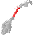
 Rødøy within Nordland |
|||
| Coordinates: 66°35′36″N 13°21′34″E / 66.59333°N 13.35944°ECoordinates: 66°35′36″N 13°21′34″E / 66.59333°N 13.35944°E | |||
| Country | Norway | ||
| County | Nordland | ||
| District | Helgeland | ||
| Administrative centre | Vågaholmen | ||
| Government | |||
| • Mayor (2003) | Olav Terje Hoff (Sp) | ||
| Area | |||
| • Total | 711.29 km2 (274.63 sq mi) | ||
| • Land | 686.16 km2 (264.93 sq mi) | ||
| • Water | 25.13 km2 (9.70 sq mi) | ||
| Area rank | 156 in Norway | ||
| Population (2017) | |||
| • Total | 1,267 | ||
| • Rank | 375 in Norway | ||
| • Density | 1.8/km2 (5/sq mi) | ||
| • Change (10 years) | -5.7 % | ||
| Demonym(s) | Rødøyfjerding | ||
| Time zone | CET (UTC+1) | ||
| • Summer (DST) | CEST (UTC+2) | ||
| ISO 3166 code | NO-1836 | ||
| Official language form | Neutral | ||
| Website | www |
||
|
|
|||
Rødøy is a municipality in Nordland county, Norway. It is part of the Helgeland traditional region. The administrative centre of the municipality is the village of Vågaholmen. Other villages include Gjerøy, Jektvika, Kilboghamn, Melfjorden, Oldervika, Sørfjorden, and Tjong. The municipality consists of many islands to the west of Norway's second biggest glacier, Svartisen.
The 711-square-kilometre (275 sq mi) municipality is the 156th largest by area out of the 426 municipalities in Norway. Rødøy is the 375th most populous municipality in Norway with a population of 1,267. The municipality's population density is 1.8 inhabitants per square kilometre (4.7/sq mi) and its population has decreased by 5.7% over the last decade.
The municipality of Rødøy was established on 1 January 1838 (see formannskapsdistrikt). On 1 January 1884, the northern district of Rødøy was separated to form the new municipality of Meløy. This division left Rødøy with 1,945 residents. The borders of the municipality have not changed since that time.
The Old Norse form of the name was Rauðøy. The first element is rauðr which means "red" (probably referring to the color of the rocks of the island) and the last element is øy which means "island".
The coat-of-arms is from modern times; they were granted on 12 February 1988. The arms show a red lion on a silver background symbolizing the mountain called Rødøyløva (English: the lion of Rødøy) because its profile resembles a lion. (See picture). It is not the highest mountain in the municipality, however, Blokktinden is one that is higher.
...
Wikipedia


