Qiemo County
|
Qiemo County 且末县 • چەرچەن ناھىيىسى |
|
|---|---|
| County | |

Main entrance of a bazaar in the county seat of Qiemo
|
|
 Location of Qiemo County (pink) in Bayingolin Prefecture (yellow) and Xinjiang |
|
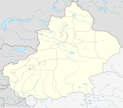
| Location of the county seat in Xinjiang | |
| Coordinates: 38°08′N 85°31′E / 38.133°N 85.517°ECoordinates: 38°08′N 85°31′E / 38.133°N 85.517°E | |
| Country | People's Republic of China |
| Region | Xinjiang |
| Autonomous prefecture | Bayingolin |
| Area | |
| • Total | 138,645 km2 (53,531 sq mi) |
| Time zone | China Standard (UTC+8) |
The Cherchen County (Chinese: 且末; pinyin: Qiěmò, Uyghur: Чәрчән Наһийиси) is a county under the administration of the Bayin'gholin Mongol Autonomous Prefecture in the Xinjiang Uyghur Autonomous Region of the People's Republic of China, bordering the Tibet Autonomous Region to the south. Its area is 138,645 square kilometres (53,531 sq mi) and, according to the 2002 census, it has a population of 60,000. The county seat is at Qiemo Town.
"Qiemo (W-G: Ch'ieh-mo) 且末 = modern Cherchen or Charchan (Uyghur: Qarqan). There has been uncertainty about this name as Chavannes (1907), p. 156, and then Stein (1921a), Vol. I, 296 ff., gave an incorrect romanization for the first character. Chavannes, using the French EFEO romanisation system, gave tsiu, and Stein used the Wade-Giles equivalent, chü. In fact, the character is correctly rendered k’ie in EFEO, ch’ieh in Wade-Giles and qie in pinyin. Nevertheless, there has never been any serious dispute about its identification with modern Cherchen."
It has been suggested that the name "Cherchen" may have been derived from Shanshan, the kingdom that once ruled the area. A number of different names have been used for the town, Lionel Giles has recorded the following names for Ruoqiang Town (with his Wade-Giles forms of the Chinese names converted to pinyin):
It was called Calmadana in Kharoshthi documents found in the region.
From the south to the north, the lands of the county run from the main range of the Kunlun Mountains (which forms the border with the Tibet Autonomous Region) to the middle of the Taklamakan Desert. The southernmost area of the county includes the northern side of part of the Ulugh Muztagh range (the main range of the Kunlun), and a section of the Altyn-Tagh range which runs roughly parallel to the main range of the Kunlun. Most of the county population lives in the northern foothills of the mountains, in the oases watered by snow-fed rivers.
...
Wikipedia

