Praratoud
| Surpierre | ||
|---|---|---|

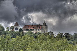
Bailiff's Castle above Surpierre village
|
||
|
||
| Coordinates: 46°45′N 6°52′E / 46.750°N 6.867°ECoordinates: 46°45′N 6°52′E / 46.750°N 6.867°E | ||
| Country | Switzerland | |
| Canton | Fribourg | |
| District | Broye | |
| Government | ||
| • Mayor | Syndic | |
| Area | ||
| • Total | 8.35 km2 (3.22 sq mi) | |
| Elevation | 618 m (2,028 ft) | |
| Population (Dec 2015) | ||
| • Total | 704 | |
| • Density | 84/km2 (220/sq mi) | |
| Postal code | 1528 | |
| SFOS number | 2044 | |
| Surrounded by | Cheiry, Cremin (VD), Forel-sur-Lucens (VD), Granges-près-Marnand (VD), Lucens (VD), Villeneuve | |
| Website |
www SFSO statistics |
|
Surpierre is a municipality in the district of Broye, in the canton of Fribourg, Switzerland. In January 2005 Surpierre incorporated the formerly independent municipality of Praratoud and In January 2017 Surpierre incorporated the formlery independent municipality of Villeneuve.
Surpierre is first mentioned in 1142 as Super Petram.
After the 2017 merger Surpierre had an area of 8.35 km2 (3.22 sq mi).
Before the merger Surpierre had an area, (as of the 2004/09 survey) of 4.77 square kilometers (1.84 sq mi). Of this area, about 57.4% is used for agricultural purposes, while 37.9% is forested. Of the rest of the land, 4.6% is settled (buildings or roads). In the 2013/18 survey a total of 15 ha (37 acres) or about 3.1% of the total area was covered with buildings, an increase of 5 ha (12 acres) over the 1981 amount. Over the same time period, the amount of recreational space in the municipality decreased by 0 ha (0 acres) and is now about 0.00% of the total area. Of the agricultural land, 3 ha (7.4 acres) is used for orchards and vineyards, 276 ha (680 acres) is fields and grasslands and 0 ha (0 acres) consists of alpine grazing areas. Since 1981 the amount of agricultural land has decreased by 5 ha (12 acres). Over the same time period the amount of forested land has decreased by 0 ha (0 acres). Rivers and lakes cover 0 ha (0 acres) in the municipality.
The municipality is located in the Broye district, in an exclave in the canton of Vaud. The village is on a cliff overlooking the Broye valley. It consists of the villages of Surpierre and Praratoud.
The blazon of the municipal coat of arms is Azure, three Plates.
Surpierre has a population (as of December 2015[update]) of 704. As of 2008[update], 5.1% of the population are resident foreign nationals. Over the last 10 years (2000–2010) the population has changed at a rate of 4.8%. Migration accounted for 13.6%, while births and deaths accounted for -0.7%.
...
Wikipedia


