Cheiry
| Cheiry | ||
|---|---|---|
 |
||
|
||
| Coordinates: 46°45′N 6°50′E / 46.750°N 6.833°ECoordinates: 46°45′N 6°50′E / 46.750°N 6.833°E | ||
| Country | Switzerland | |
| Canton | Fribourg | |
| District | Broye | |
| Government | ||
| • Mayor | Syndic | |
| Area | ||
| • Total | 6.48 km2 (2.50 sq mi) | |
| Elevation | 563 m (1,847 ft) | |
| Population (Dec 2015) | ||
| • Total | 379 | |
| • Density | 58/km2 (150/sq mi) | |
| Postal code | 1529 | |
| SFOS number | 2009 | |
| Localities | Cheiry, Chapelle, Coumin-Dessus, Coumin-Dessous | |
| Surrounded by | Combremont-le-Grand (VD), Combremont-le-Petit (VD), Forel-sur-Lucens (VD), Granges-près-Marnand (VD), Prévondavaux, Sassel (VD), Surpierre | |
| Website |
http://www.cheiry.ch SFSO statistics |
|
Cheiry (Arpitan: ![]() Tsèri ) is a municipality in the district of Broye in the canton of Fribourg in Switzerland.
Tsèri ) is a municipality in the district of Broye in the canton of Fribourg in Switzerland.
Cheiry is first mentioned around 1184-85 as Chirie. Its territory was enlarged in 2005 with the formerly independent municipality Chapelle.
Cheiry has an area, as of 2009[update], of 6.5 square kilometers (2.5 sq mi). Of this area, 4.25 km2 (1.64 sq mi) or 65.6% is used for agricultural purposes, while 1.76 km2 (0.68 sq mi) or 27.2% is forested. Of the rest of the land, 0.45 km2 (0.17 sq mi) or 6.9% is settled (buildings or roads) and 0.02 km2 (4.9 acres) or 0.3% is unproductive land.
Of the built up area, housing and buildings made up 2.5% and transportation infrastructure made up 3.4%. Out of the forested land, 24.4% of the total land area is heavily forested and 2.8% is covered with orchards or small clusters of trees. Of the agricultural land, 42.7% is used for growing crops and 22.4% is pastures.
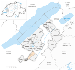
The municipality is located in the Broye district, in the Surpierre exclave.
The blazon of the municipal coat of arms is Per fess, Or a Semi-Eagle displayed issuant Gules, and Azure three Plates.
...
Wikipedia


