Granges-près-Marnand
| Granges-près-Marnand | |
|---|---|
| Former municipality of Switzerland | |
 |
|
| Coordinates: 46°46′N 6°53′E / 46.767°N 6.883°ECoordinates: 46°46′N 6°53′E / 46.767°N 6.883°E | |
| Country | Switzerland |
| Canton | Vaud |
| District | Broye-Vully |
| Area | |
| • Total | 7.02 km2 (2.71 sq mi) |
| Elevation | 473 m (1,552 ft) |
| Population | |
| • Total | 1,210 |
| • Density | 170/km2 (450/sq mi) |
| Postal code | 1523 |
| SFOS number | 5818 |
| Surrounded by | Cheiry (FR), Fétigny (FR), Henniez, Marnand, Ménières (FR), Sassel, Surpierre (FR), Trey, Villeneuve (FR) |
| Website | Profile (French), SFSO statistics |
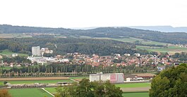
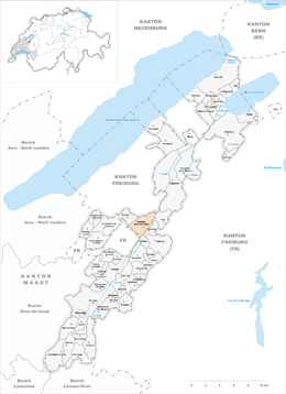
Granges-près-Marnand is a former municipality in the district of Broye-Vully in the canton of Vaud in Switzerland.
The municipalities of Cerniaz, Combremont-le-Grand, Combremont-le-Petit, Granges-près-Marnand, Marnand, Sassel, Seigneux and Villars-Bramard merged on 1 July 2011 into the new municipality of Valbroye.
Granges-près-Marnand is first mentioned in 881 as in fine Graniacense. In 1228 it was mentioned as Granges. The current name was adopted in 1952.
Granges-près-Marnand has an area, as of 2009[update], of 7.02 square kilometers (2.71 sq mi). Of this area, 4.47 km2 (1.73 sq mi) or 63.7% is used for agricultural purposes, while 1.5 km2 (0.58 sq mi) or 21.4% is forested. Of the rest of the land, 0.91 km2 (0.35 sq mi) or 13.0% is settled (buildings or roads), 0.15 km2 (37 acres) or 2.1% is either rivers or lakes.
Of the built up area, industrial buildings made up 2.1% of the total area while housing and buildings made up 4.4% and transportation infrastructure made up 3.3%. Power and water infrastructure as well as other special developed areas made up 2.6% of the area Out of the forested land, 20.2% of the total land area is heavily forested and 1.1% is covered with orchards or small clusters of trees. Of the agricultural land, 53.4% is used for growing crops and 9.7% is pastures. All the water in the municipality is flowing water.
The municipality was part of the Payerne District until it was dissolved on 31 August 2006, and Granges-près-Marnand became part of the new district of Broye-Vully.
The municipality is located on the left bank of the Broye river. It consists of the village of Granges-près-Marnand and the hamlet of Brit.
...
Wikipedia


