Place Jacques-Cartier
| Place Jacques-Cartier | |
|---|---|

View from the plaza toward Nelson's Column and the Montreal City Hall in 2011.
|
|
| Type | Town square |
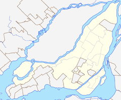
| Location | Old Montreal, Ville-Marie Montreal, Quebec, Canada |
| Coordinates | 45°30′28″N 73°33′11″W / 45.507889°N 73.553°WCoordinates: 45°30′28″N 73°33′11″W / 45.507889°N 73.553°W |
| Created | 1847 |
| Operated by | City of Montreal |
| Public transit access | Champ-de-Mars |
Place Jacques-Cartier is a square located in Old Montreal in Montreal, Quebec, Canada, and an entrance to the Old Port of Montreal.
In 1723, the Château Vaudreuil was built for Philippe de Rigaud, Marquis de Vaudreuil - its formal gardens occupying the space that is now the square. The Chateau burned down in 1803 and it was suggested by The Hon. Jean-Baptiste Durocher and The Hon. Joseph Périnault that the space be transformed into a public square, known as New Market Place. In 1809, Montreal's oldest public monument was raised there, Nelson's Column. In 1847, the square was renamed in honour of Jacques Cartier, the explorer who claimed Canada for France in 1535.
The broad, divided street slopes steeply downhill from Montreal City Hall and rue Notre-Dame to the waterfront and rue de la Commune. During the high tourist season, the street hosts many street artists and kiosks. During the Christmas season, the street is lined with lighted trees. At any time of year, one can find restaurants on both sides of the street and many more on the surrounding streets of Vieux Port, notably on Rue Saint-Paul.
It is a car-free zone in the summer. During the summer season, Jardin Nelson offers a garden restaurant on Place Jacques-Cartier. Other restaurants similarly offer classical Parisian-style "terraces" for taking a drink or dining in the open air.
...
Wikipedia

