Pléchâtel
|
Pléchâtel Plegastell |
|
|---|---|
| Commune | |

The church of Pléchâtel
|
|
| Coordinates: 47°53′43″N 1°44′50″W / 47.8953°N 1.7472°WCoordinates: 47°53′43″N 1°44′50″W / 47.8953°N 1.7472°W | |
| Country | France |
| Region | Brittany |
| Department | Ille-et-Vilaine |
| Arrondissement | Redon |
| Canton | Bain-de-Bretagne |
| Intercommunality | Moyenne Vilaine et du Semnon |
| Government | |
| • Mayor (2014–2020) | Éric Bourasseau |
| Area1 | 36.32 km2 (14.02 sq mi) |
| Population (2008)2 | 2,685 |
| • Density | 74/km2 (190/sq mi) |
| Time zone | CET (UTC+1) |
| • Summer (DST) | CEST (UTC+2) |
| INSEE/Postal code | 35221 /35470 |
| Elevation | 7–116 m (23–381 ft) |
|
1 French Land Register data, which excludes lakes, ponds, glaciers > 1 km² (0.386 sq mi or 247 acres) and river estuaries. 2Population without double counting: residents of multiple communes (e.g., students and military personnel) only counted once. |
|
1 French Land Register data, which excludes lakes, ponds, glaciers > 1 km² (0.386 sq mi or 247 acres) and river estuaries.
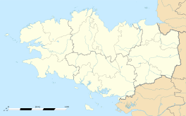
Pléchâtel (Breton: Plegastell) is a commune in the Ille-et-Vilaine department of Brittany in northwestern France.
The river Semnon forms all of the commune's northern border, then flows into the Vilaine, which forms all of its western border.
Inhabitants of Pléchâtel are called Pléchâtellois in French.
...
Wikipedia


