Perrysburg, OH
| Perrysburg, Ohio | |
|---|---|
| City | |
| Motto: "Embracing Our Past. Poised For The Future." | |
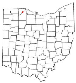
 Location of Perrysburg in Ohio |
|
 Location of Perrysburg in Wood County |
|
| Coordinates: 41°33′1″N 83°37′48″W / 41.55028°N 83.63000°WCoordinates: 41°33′1″N 83°37′48″W / 41.55028°N 83.63000°W | |
| Country | United States |
| State | Ohio |
| County | Wood |
| Government | |
| • Mayor | Mike Olmstead |
| Area | |
| • Total | 11.51 sq mi (29.81 km2) |
| • Land | 11.51 sq mi (29.81 km2) |
| • Water | 0 sq mi (0 km2) |
| Elevation | 630 ft (192 m) |
| Population (2010) | |
| • Total | 20,623 |
| • Estimate (2015) | 21,423 |
| • Density | 1,791.7/sq mi (691.8/km2) |
| Time zone | Eastern (EST) (UTC-5) |
| • Summer (DST) | EDT (UTC-4) |
| ZIP codes | 43551–43552 |
| Area code(s) | 419 |
| FIPS code | 39-62148 |
| GNIS feature ID | 1066139 |
| Website | ci |
Perrysburg is a city in Wood County, Ohio, United States, along the south side of the Maumee River. The population was 20,623 at the 2010 census. Located about 12 miles southwest of Toledo, it was founded before the now larger port city on Lake Erie. It has become a suburb of the city.
Perrysburg lies near the center of the Twelve Mile Square Reservation, a tract of land ceded by the Odawa people to the United States of America by the Treaty of Greenville in 1795 following the end of the Northwest Indian Wars. They had occupied this territory since the turn of the 18th century, after having settled in the region of the French trading post at Fort Detroit. The Odawa had controlled much of the territory along the Maumee River in present-day northwestern Ohio.
In 1810, early European-American settlers here were Major Amos Spafford (1753-1818), his wife Olive (1756-1823), and their four children. In 1796, Spafford, a native of Connecticut, was a surveyor for the Connecticut Land Company. He drew the first map laying out Cleveland and named the city. He left there in 1810 following appointment as custom's collector and postmaster for the new port at the foot of the rapids of the Maumee River, Port Miami of Lake Erie. Spafford was granted a 160-acre land patent on River Tract #64 in Waynesfield township, signed by President James Monroe. Two years later, 67 families lived in the area, but most fled at the outbreak of the War of 1812. After the war and the 1817 Treaty of Fort Meigs, which extinguished Odawa claim to this area, Spafford purchased the land.
...
Wikipedia
