Penmarks
|
Penmarch Penmarc'h |
||
|---|---|---|
| Commune | ||

Lighthouses on the Pointe de Penmarc'h
|
||
|
||
| Coordinates: 47°48′46″N 4°20′12″W / 47.8127°N 4.3366°WCoordinates: 47°48′46″N 4°20′12″W / 47.8127°N 4.3366°W | ||
| Country | France | |
| Region | Brittany | |
| Department | Finistère | |
| Arrondissement | Quimper | |
| Canton | Pont-l'Abbé | |
| Intercommunality | Pays Bigouden Sud | |
| Government | ||
| • Mayor (2014–2020) | Raynald Tanter | |
| Area1 | 16.39 km2 (6.33 sq mi) | |
| Population (2008)2 | 5,633 | |
| • Density | 340/km2 (890/sq mi) | |
| Time zone | CET (UTC+1) | |
| • Summer (DST) | CEST (UTC+2) | |
| INSEE/Postal code | 29158 /29760 | |
| Elevation | −1–23 m (−3.3–75.5 ft) | |
|
1 French Land Register data, which excludes lakes, ponds, glaciers > 1 km2 (0.386 sq mi or 247 acres) and river estuaries. 2Population without double counting: residents of multiple communes (e.g., students and military personnel) only counted once. |
||
1 French Land Register data, which excludes lakes, ponds, glaciers > 1 km2 (0.386 sq mi or 247 acres) and river estuaries.
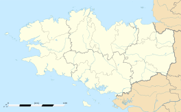
Penmarc'h or Penmarch is a commune in the Finistère department of Brittany in north-western France. It lies 18 km south-west of Quimper by road.
Penmarch is the southwest most township of Pays Bigouden, at the southern end of the Bay of Audierne. It is the most populous township of the Guilvinec's canton, with a population of 5,889 inhabitants in 1999 (21,813 for the entire township).
The territory of the town is particularly flat and a very low altitude. There are many marshy lagoons, some of which have been drained and filled, especially in St. Guénolé to save space or habitat for the installation of local handicrafts.
The municipality consists of four villages:
Many islands or reefs of very variable dimensions punctuate the coast of Penmarch; the most important are the Etocs south of Kerity, and the island St. Nonna west of Saint-Pierre.
The port of Saint-Guénolé has a pass opening due west, thought to be dangerous in rough weather. It is protected by two granite peninsulas: Krugen in the South, and Conq in the northwest. Krugen is connected to the mainland by a sandy isthmus. Conq is connected to shore by an artificial embankment itself protected by concrete blocks to better break the flood wave.
The rocky granite coast (called "savage coast" in St. Guénolé) is interspersed with several beaches:
On the extremity of the peninsula on which it is situated are fortified remains of a town which was of considerable importance from the 14th to the 16th centuries and included, besides Penmarc'h, Saint-Guénolé and Kerity. It owed its prosperity to its cod-banks, the disappearance of which, together with the discovery of the Newfoundland cod-banks and the pillage of the place by the bandit La Fontenelle in 1595, contributed to its decline.
...
Wikipedia


