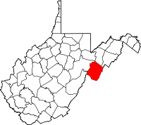
Pendleton County, West Virginia
| Pendleton County, West Virginia | |
|---|---|

Pendleton County Courthouse
|
|
 Location in the U.S. state of West Virginia |
|
 West Virginia's location in the U.S. |
|
| Founded | 1788 |
| Named for | Edmund Pendleton |
| Seat | Franklin |
| Largest town | Franklin |
| Area | |
| • Total | 698 sq mi (1,808 km2) |
| • Land | 696 sq mi (1,803 km2) |
| • Water | 2.1 sq mi (5 km2), 0.3% |
| Population (est.) | |
| • (2015) | 7,229 |
| • Density | 10/sq mi (4/km²) |
| Congressional district | 2nd |
| Time zone | Eastern: UTC-5/-4 |
| Website | www |
Pendleton County is a county located in the U.S. state of West Virginia. As of the 2010 census, the population was 7,695, making it the fifth-least populous county in West Virginia. Its county seat is Franklin. The county was created by the Virginia General Assembly in 1788 from parts of Augusta, Hardy, and Rockingham Counties and was named for Edmund Pendleton (1721–1803), a distinguished Virginia statesman and jurist. Pendleton County was strongly pro-Confederate during the American Civil War; however, there were pockets of Union support.
Spruce Knob, located in Pendleton County, is the highest point in the state and in the Alleghenies, its elevation being 4,863 feet. Parts of the Monongahela and George Washington National Forests are also located in Pendleton.
By the 1740s, the three main valleys of what became Pendleton County had been visited and named by white hunters and prospectors. One of the hunters, a single man named Abraham Burner, built himself a log cabin about a half mile downstream of the future site of Brandywine in 1745. He was the county's first white settler. A local historian recorded that:
The site ...[was] on the left bank of the river, and near the beginning of a long, eastward bend. From almost at his very door his huntsman's eye was at times gladdened by seeing perhaps fifty deer either drinking from the steam or plunging in their heads up to their ears in search of moss.
...
Wikipedia
