Augusta County, Virginia
| Augusta County, Virginia | |||
|---|---|---|---|

The Augusta County Courthouse in March 2005
|
|||
|
|||
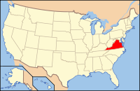
 Location in the U.S. state of Virginia |
|||
 Virginia's location in the U.S. |
|||
| Founded | 1738 | ||
| Named for | Princess Augusta of Saxe-Gotha | ||
| Seat | Staunton | ||
| Largest community | Stuarts Draft | ||
| Area | |||
| • Total | 971 sq mi (2,515 km2) | ||
| • Land | 967 sq mi (2,505 km2) | ||
| • Water | 3.9 sq mi (10 km2), 0.4% | ||
| Population (est.) | |||
| • (2015) | 74,314 | ||
| • Density | 77/sq mi (30/km²) | ||
| Congressional district | 6th | ||
| Time zone | Eastern: UTC-5/-4 | ||
| Website | www |
||
Coordinates: 38°12′N 79°7′W / 38.200°N 79.117°W
Augusta County is a county located in the Shenandoah Valley on the western edge of the U.S. commonwealth of Virginia. It is the second-largest county in Virginia by total area, and it surrounds the independent cities of Staunton and Waynesboro. The county seat of Augusta is Staunton, although most of the administrative services have offices in neighboring Verona.
The county was created in 1738 from part of Orange County, and was named after Princess Augusta of Saxe-Gotha. It was originally a huge area, but many parts of Augusta County were carved out to form other counties and several states, until the current border was finalized in 1790.
As of the 2010 census, the county population was 73,750, which represented an increase of more than 34 percent over the 1990 figure. In addition, Augusta County is part of the Staunton–Waynesboro, VA Metropolitan Statistical Area.
Augusta County was formed in 1738 from Orange County, although, because few people lived there, the county government was not organized until 1745. It was named for Augusta of Saxe-Gotha, Princess of Wales and mother of the future King George III of the United Kingdom.
...
Wikipedia


