Parshall, North Dakota
| Parshall, North Dakota | |
|---|---|
| City | |

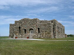
Paul Broste Rock Museum in Parshall
|
|
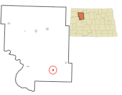
 Location of Parshall, North Dakota |
|
| Coordinates: 47°57′17″N 102°8′4″W / 47.95472°N 102.13444°WCoordinates: 47°57′17″N 102°8′4″W / 47.95472°N 102.13444°W | |
| Country | United States |
| State | North Dakota |
| County | Mountrail |
| Area | |
| • Total | 0.55 sq mi (1.42 km2) |
| • Land | 0.55 sq mi (1.42 km2) |
| • Water | 0 sq mi (0 km2) |
| Elevation | 1,932 ft (589 m) |
| Population (2010) | |
| • Total | 903 |
| • Estimate (2016) | 1,253 |
| • Density | 1,600/sq mi (640/km2) |
| Time zone | Central (CST) (UTC-6) |
| • Summer (DST) | CDT (UTC-5) |
| ZIP code | 58770 |
| Area code(s) | 701 |
| FIPS code | 38-60940 |
| GNIS feature ID | 1030639 |
| Website | www.parshallnd.com |
Parshall (Hidatsa: dibiarugareesh) is a city lying within the jurisdictional boundaries of the Mandan, Hidatsa, and Arikara Nation. It is located on the Fort Berthold Indian Reservation in Mountrail County, North Dakota, United States. Its population was 903 at the 2010 census. Parshall was founded in 1914 by George Parshall, and is the home of the Paul Broste Rock Museum.
On February 15, 1936, Parshall recorded a temperature of -60 °F (-51 °C), setting a state record low temperature, which still stands today.
Randy Hedberg, a former NFL quarterback, was born and raised in Parshall.
Parshall is located at 47°57′17″N 102°8′4″W / 47.95472°N 102.13444°W (47.954806, -102.134513).
According to the United States Census Bureau, the city has a total area of 0.55 square miles (1.42 km2), all of it land.
As of the census of 2010, there were 903 people, 313 households, and 220 families residing in the city. The population density was 1,641.8 inhabitants per square mile (633.9/km2). There were 364 housing units at an average density of 661.8 per square mile (255.5/km2). The racial makeup of the city was 30.6% White, 0.3% African American, 62.7% Native American, 0.7% from other races, and 5.8% from two or more races. Hispanic or Latino of any race were 6.5% of the population.
...
Wikipedia
