Paradela, Lugo
| Paradela | |||
|---|---|---|---|
| Municipality | |||
|
|||
 |
|||
| Location in Spain | |||
| Coordinates: 42°58′N 7°57′W / 42.967°N 7.950°WCoordinates: 42°58′N 7°57′W / 42.967°N 7.950°W | |||
| Country |
|
||
| Autonomous community |
|
||
| Province | Lugo | ||
| Comarca | Sarria | ||
| Government | |||
| • Alcalde | José Manuel Mato Díaz (2007) | ||
| Area | |||
| • Total | 121.12 km2 (46.76 sq mi) | ||
| Population (2008) | |||
| • Total | 2,193 | ||
| • Density | 18/km2 (47/sq mi) | ||
| Demonym(s) | Paradelense | ||
| Time zone | CET (UTC+1) | ||
| • Summer (DST) | CEST (UTC+2) | ||
| Official language(s) | Galician, Spanish | ||
| Website | Official website | ||
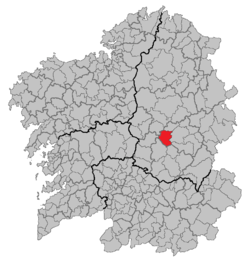
Paradela is a municipality in Lugo province in Galicia in north-west Spain. It is situated in the region of Sarria. There were 2,193 people living in Paradela as of 2008 (1,101 men and 1,092 women). It is known for the connection it has with the Way of St. James. The French route of such a way, ending in Santiago de Compostela, passes through five parishes of Paradela: Ferreiros, Francos, Laxe, Cortes and Loio.
The name Paradela comes from the diminutive of the Latin word parata, which can be translated as hostal, or near the end of the journey.
Here is a list of all parishes within Paradela, each having their own saint shown in brackets.
...
Wikipedia


