Palisades Park, New Jersey
| Palisades Park, New Jersey | |
|---|---|
| Borough | |
| Borough of Palisades Park | |
 Map highlighting Palisades Park's location within Bergen County. Inset: Bergen County's location within New Jersey. |
|
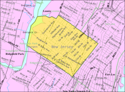
 Census Bureau map of Palisades Park, New Jersey |
|
| Coordinates: 40°50′49″N 73°59′49″W / 40.847017°N 73.997062°WCoordinates: 40°50′49″N 73°59′49″W / 40.847017°N 73.997062°W | |
| Country | |
| State |
|
| County | Bergen |
| Incorporated | March 22, 1899 |
| Government | |
| • Type | Borough |
| • Body | Borough Council |
| • Mayor | James Rotundo (D, term ends December 31, 2018) |
| • Administrator | David J. Lorenzo |
| • Clerk | Gina S. Kim |
| Area | |
| • Total | 1.276 sq mi (3.304 km2) |
| • Land | 1.251 sq mi (3.241 km2) |
| • Water | 0.025 sq mi (0.064 km2) 1.93% |
| Area rank | 479th of 566 in state 61st of 70 in county |
| Elevation | 112 ft (34 m) |
| Population (2010 Census) | |
| • Total | 19,622 |
| • Estimate (2015) | 20,743 |
| • Rank | 132nd of 566 in state 14th of 70 in county |
| • Density | 15,681.6/sq mi (6,054.7/km2) |
| • Density rank | 14th of 566 in state 3rd of 70 in county |
| Time zone | Eastern (EST) (UTC-5) |
| • Summer (DST) | Eastern (EDT) (UTC-4) |
| ZIP code | 07650 |
| Area code(s) | 201 |
| FIPS code | 3400355770 |
| GNIS feature ID | 0885338 |
| Website | www |
Palisades Park is a borough in Bergen County, New Jersey, United States. As of the 2010 United States Census, the borough's population was 19,622, reflecting an increase of 2,549 (+14.9%) from the 17,073 counted in the 2000 Census, which had in turn increased by 2,537 (+17.5%) from the 14,536 counted in the 1990 Census.
The borough of Palisades Park was created by an act of the New Jersey Legislature on March 22, 1899, from portions of Ridgefield Township. A portion of its area was annexed by the neighboring borough of Fort Lee in April 1909. The borough was named for its location atop the New Jersey Palisades.
According to the United States Census Bureau, the borough had a total area of 1.276 square miles (3.304 km2), including 1.251 square miles (3.241 km2) of land and 0.025 square miles (0.064 km2) of water (1.93%).
The borough borders Fort Lee, Leonia, Ridgefield and Ridgefield Park.
Unincorporated communities, localities and place names located partially or completely within the borough include Morsemere.
The 2010 United States Census counted 19,622 people, 6,934 households, and 5,020 families residing in the borough. The population density was 15,681.6 per square mile (6,054.7/km2). The borough contained 7,362 housing units at an average density of 5,883.6 per square mile (2,271.7/km2). The racial makeup of the borough was 28.90% (5,670) White, 1.96% (385) Black or African American, 0.31% (60) Native American, 57.84% (11,350) Asian, 0.05% (10) Pacific Islander, 9.00% (1,765) from other races, and 1.95% (382) from two or more races. Hispanics or Latinos of any race were 18.22% (3,575) of the population.
...
Wikipedia
