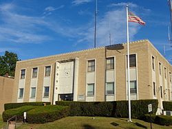
Ridgefield, New Jersey
| Ridgefield, New Jersey | |
|---|---|
| Borough | |
| Borough of Ridgefield | |

Borough Hall
|
|
 Map highlighting Ridgefield's location within Bergen County. Inset: Bergen County's location within New Jersey. |
|
 Census Bureau map of Ridgefield, New Jersey |
|
| Coordinates: 40°49′56″N 74°00′54″W / 40.832337°N 74.015134°WCoordinates: 40°49′56″N 74°00′54″W / 40.832337°N 74.015134°W | |
| Country | |
| State |
|
| County | Bergen |
| Incorporated | May 26, 1892 |
| Government | |
| • Type | Borough |
| • Body | Borough Council |
| • Mayor | Anthony R. Suarez (D, term ends December 31, 2019) |
| • Administrator | Ray Ramirez |
| • Clerk | Linda Silvestri |
| Area | |
| • Total | 2.854 sq mi (7.394 km2) |
| • Land | 2.551 sq mi (6.608 km2) |
| • Water | 0.303 sq mi (0.786 km2) 10.62% |
| Area rank | 347th of 566 in state 31st of 70 in county |
| Elevation | 10 ft (3 m) |
| Population (2010 Census) | |
| • Total | 11,032 |
| • Estimate (2015) | 11,373 |
| • Rank | 223rd of 566 in state 32nd of 70 in county |
| • Density | 4,323.7/sq mi (1,669.4/km2) |
| • Density rank | 137th of 566 in state 34th of 70 in county |
| Time zone | Eastern (EST) (UTC-5) |
| • Summer (DST) | Eastern (EDT) (UTC-4) |
| ZIP code | 07657 |
| Area code(s) | 201 |
| FIPS code | 3400362910 |
| GNIS feature ID | 0885367 |
| Website | www |
Ridgefield is a borough in Bergen County, New Jersey, United States. As of the 2010 United States Census, the borough's population was 11,032, reflecting an increase of 202 (+1.9%) from the 10,830 counted in the 2000 Census, which had in turn increased by 834 (+8.3%) from the 9,996 counted in the 1990 Census.
Ridgefield was incorporated as a borough by an act of the New Jersey Legislature on May 26, 1892, from portions of Ridgefield Township. The borough was named for the area's terrain.
At the time of European colonization, the area was home to the Hackensack tribe of the Lenape Native Americans, who maintained a large settlement to the north on Overpeck Creek. Their name is an exonym taken from the territory and is translated as place of stony ground which describes the diminishing Hudson Palisades as they descend into the Meadowlands becoming the ridgefield that is part of Hackensack River flood plain.
In 1642, Myndert Myndertsen received a patroonship as part of the New Netherland colony for much the land in the Hackensack and Passaic valleys. He called his settlement Achter Kol, or rear mountain pass, which refers to its accessibility to the interior behind the Palisades. Originally spared in the conflicts that begin with the Pavonia Massacre, the nascent colony was later abandoned. In 1655, Oratam, sachem of the Hackensack, deeded a large tract nearby to Sara Kiersted, who had learned the native language and was instrumental in negotiations between Native Americans and the settlers. In 1668, much of the land between Overpeck Creek and the Hudson River was purchased by Samuel Edsall, and soon became known as the English Neighborhood, despite the fact most of the settlers were of Dutch and Huguenot origin.
...
Wikipedia
