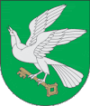
Pagėgiai
| Pagėgiai | |||
|---|---|---|---|
| City | |||
 |
|||
|
|||
| Location of Pagėgiai | |||
| Coordinates: 55°8′0″N 21°55′0″E / 55.13333°N 21.91667°ECoordinates: 55°8′0″N 21°55′0″E / 55.13333°N 21.91667°E | |||
| Country |
|
||
| Ethnographic region | Lithuania Minor | ||
| County | Tauragė County | ||
| Municipality | Pagėgiai municipality | ||
| Eldership | Pagėgiai eldership | ||
| Capital of | Pagėgiai eldership | ||
| Granted city rights | 1923 | ||
| Population (2005) | |||
| • Total | 2,321 | ||
| Time zone | EET (UTC+2) | ||
| • Summer (DST) | EEST (UTC+3) | ||
| Website | http://www.pagegiai.lt | ||
Pagėgiai (![]() pronunciation , German: Pogegen) is a city in the south western Lithuania. It is located in the region of the former prussian tribe of Skalvians. It is the capital of Pagėgiai municipality, and as such it is part of Tauragė County.
pronunciation , German: Pogegen) is a city in the south western Lithuania. It is located in the region of the former prussian tribe of Skalvians. It is the capital of Pagėgiai municipality, and as such it is part of Tauragė County.
The name of the town literally means "at Gėgė" (gegis: grove of alders, hay meadows, fields) and it is believed that the Gėgė river (also Gäge, Jäge) once flowed through the town.
When the Treaty of Versailles came in effect in January 1920, the Klaipėda Region located north of the Neman River was separated from Germany.
The northern trans-Neman parts of Kreis Ragnit and both Landkreis and Stadtkreis Tilsit, which had been established in 1818, as well as Gutsbezirk Perwallkischken were combined on 27 January 1920 to the new Kreis Pogegen, with Pagėgiai as capital.
When Lithuania assumed control of the region in 1923, it was renamed Pagėgiai Apskritis. In 1939 the area was reintegrated by Nazi Germany in March into East Prussia and renamed Landkreis Pogegen. It consisted of 164 Landgemeinden with less than 2,000 inhabitants, and 34 Gutsbezirke. The largest community was Schmalleningken with a pop. of 1,700. Pogegen and the community of Wischwill had 1,400 each.
...
Wikipedia


