Oregon (State)
| State of Oregon | |||||
|---|---|---|---|---|---|
|
|||||
| Nickname(s): Beaver State | |||||
|
Motto(s): Alis volat propriis (English: She flies with her own wings) |
|||||
| State song(s): "Oregon, My Oregon" | |||||
| Official language |
De jure: none De facto: English |
||||
| Demonym | Oregonian | ||||
| Capital | Salem | ||||
| Largest city | Portland | ||||
| Largest metro | Portland metropolitan area | ||||
| Area | Ranked 9th | ||||
| • Total | 98,381 sq mi (254,806 km2) |
||||
| • Width | 400 miles (640 km) | ||||
| • Length | 360 miles (580 km) | ||||
| • % water | 2.4 | ||||
| • Latitude | 42° N to 46° 18′ N | ||||
| • Longitude | 116° 28′ W to 124° 38′ W | ||||
| Population | Ranked 27th | ||||
| • Total | 4,093,465 (2016 est.) | ||||
| • Density | 39.9/sq mi (15.0/km2) Ranked 39th |
||||
| • Median household income | $60,834 (17th) | ||||
| Elevation | |||||
| • Highest point |
Mount Hood 11,249 ft (3,428.8 m) |
||||
| • Mean | 3,300 ft (1,000 m) | ||||
| • Lowest point | Pacific Ocean sea level |
||||
| Before statehood | Oregon Territory | ||||
| Admission to Union | February 14, 1859 (33rd) | ||||
| Governor | Kate Brown (D) | ||||
| Secretary of State | Dennis Richardson (R) | ||||
| Legislature | Legislative Assembly | ||||
| • Upper house | State Senate | ||||
| • Lower house | House of Representatives | ||||
| U.S. Senators |
Ron Wyden (D) Jeff Merkley (D) |
||||
| U.S. House delegation | 4 Democrats, 1 Republican (list) | ||||
| Time zones | |||||
| • most of state | Pacific: UTC −8/−7 | ||||
| • most of Malheur County | Mountain: UTC −7/−6 | ||||
| ISO 3166 | US-OR | ||||
| Abbreviations | OR, Ore. | ||||
| Website | www |
||||
| Oregon state symbols | |
|---|---|

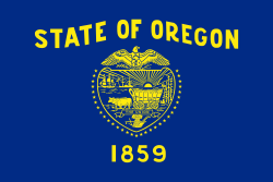
The Flag of Oregon
|
|

The Seal of Oregon
|
|
| Living insignia | |
| Bird | Western meadowlark (Sturnella neglecta) |
| Crustacean |
Dungeness crab (Metacarcinus magister) |
| Fish |
Chinook salmon (Oncorhynchus tshawytscha) |
| Flower |
Oregon grape (Mahonia aquifolium) |
| Grass |
Bluebunch wheatgrass (Pseudoroegneria spicata) |
| Insect |
Oregon swallowtail (Papilio oregonius) |
| Mammal |
American beaver (Castor canadensis) |
| Tree | Douglas-fir |
| Inanimate insignia | |
| Beverage | Milk |
| Dance | Square dance |
| Food |
Pear (Pyrus) |
| Fossil | Metasequoia |
| Gemstone | Oregon sunstone |
| Motto | Alis volat propriis |
| Rock | Thunderegg |
| Shell |
Oregon hairy triton (Fusitriton oregonensis) |
| Slogan | The Union |
| Soil | Jory soil |
| Song | "Oregon, My Oregon" |
| State route marker | |
 |
|
| State quarter | |

Released in 2005
|
|
| Lists of United States state symbols | |
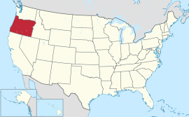
Oregon (![]() i/ˈɒrᵻɡən/) is a state in the Pacific Northwest region on the West coast of the United States. The Columbia River delineates much of Oregon's northern boundary along Washington state, while the Snake River delineates much of its eastern boundary along Idaho. The parallel 42° north delineates the southern boundary with California and Nevada. It is one of only three states of the contiguous United States to have a coastline on the Pacific Ocean.
i/ˈɒrᵻɡən/) is a state in the Pacific Northwest region on the West coast of the United States. The Columbia River delineates much of Oregon's northern boundary along Washington state, while the Snake River delineates much of its eastern boundary along Idaho. The parallel 42° north delineates the southern boundary with California and Nevada. It is one of only three states of the contiguous United States to have a coastline on the Pacific Ocean.
Oregon was inhabited by many indigenous tribes before Western traders, explorers, and settlers arrived. An autonomous government was formed in the Oregon Country in 1843 before the Oregon Territory was created in 1848. Oregon became the 33rd state on February 14, 1859. Today, at 98,000 square miles (255,000 km²), Oregon is the ninth largest and, with a population of 4 million, 27th most populous U.S. state. The state capital, Salem, is the second most populous of its cities, with 164,549 residents, while Portland, with 632,309 residents, is the most populous, ranking as the 26th most populous city in the United States. Portland's metro population of 2,389,228 ranks the 23rd largest metro in the nation.
...
Wikipedia


