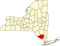
Orange County, New York
| Orange County, New York | |||
|---|---|---|---|

Island Pond in Harriman State Park, near the Village of Harriman.
|
|||
|
|||
 Location in the U.S. state of New York |
|||
 New York's location in the U.S. |
|||
| Founded | 1698 | ||
| Named for | William III of Orange | ||
| Seat | Goshen | ||
| Largest city | Newburgh | ||
| Area | |||
| • Total | 839 sq mi (2,173 km2) | ||
| • Land | 812 sq mi (2,103 km2) | ||
| • Water | 27 sq mi (70 km2), 3.2% | ||
| Population (est.) | |||
| • (2015) | 377,647 | ||
| • Density | 459/sq mi (177/km²) | ||
| Congressional district | 18th | ||
| Time zone | Eastern: UTC-5/-4 | ||
| Website | www |
||
Orange County is a county located in the U.S. state of New York. As of the 2010 census, the population was 372,813. The county seat is Goshen. This county was first created in 1683 and reorganized with its present boundaries in 1798.
Orange County is included in the New York-Newark-Jersey City, NY-NJ-PA Metropolitan Statistical Area. It is in the state's Mid-Hudson Region of the Hudson Valley.
The County Executive is Steve Neuhaus.
As of the 2010 census the centre of population of New York state was located in Orange County, approximately three miles west of the hamlet of Westbrookville.
Orange County was officially established on November 1, 1683, when the Province of New York was divided into twelve counties. Each of these was named to honor a member of the British royal family, and Orange County took its name from the Prince of Orange, who subsequently became King William III of England. As originally defined, Orange County included only the southern part of its present-day territory, plus all of present-day Rockland County further south. The northern part of the present-day county, beyond Moodna Creek, was then a part of neighbouring Ulster County.
...
Wikipedia


