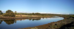
Onkaparinga Valley
| Onkaparinga (Kaurna: Ngangkiparri) | |
| River | |
|
Onkaparinga River estuary
|
|
| Country | Australia |
|---|---|
| State | South Australia |
| Region | Southern Adelaide |
| Local government area | City of Onkaparinga |
| Towns | Woodside, Oakbank, Clarendon |
| Source | Mount Lofty Range |
| - location | between Charleston and Mount Torrens |
| - elevation | 422 m (1,385 ft) |
| Mouth | Gulf St Vincent |
| - location | between Port Noarlunga South and Port Noarlunga |
| - elevation | 0 m (0 ft) |
| - coordinates | 35°09′53″S 138°28′10″E / 35.164660°S 138.469520°ECoordinates: 35°09′53″S 138°28′10″E / 35.164660°S 138.469520°E |
| Length | 88 km (55 mi) |
| Basin | 562 km2 (217 sq mi) |
| Protected areas |
Encounter Marine Park Onkaparinga River National Park Onkaparinga River Recreation Park Port Noarlunga Reef Aquatic Reserve |
| Reservoir |
Mount Bold Reservoir Clarendon Reservoir |
|
Location of the river mouth in South Australia
|
|
The Onkaparinga River, known as Ngangkiparri in the Kaurna language, is a river located in the Southern Adelaide region in the Australian state of South Australia.
The Onkaparinga River rises on the slopes of the Mount Lofty Range between Mount Torrens and Charleston and flows generally southwesterly, south of the Adelaide city centre, to reach its mouth at Port Noarlunga. The catchment area is over 500 square kilometres (190 square miles) in area, and in part includes the protected areas of the Encounter Marine Park, the Onkaparinga River National Park, the Onkaparinga River Recreation Park and the Port Noarlunga Reef Aquatic Reserve. The river descends 422 metres (1,385 ft) over its 88-kilometre (55 mi) course.
The Onkaparinga River is the second major river within the Adelaide metropolitan area, after the River Torrens. It is a source of fresh water for Adelaide. Mount Bold Reservoir was constructed between 1932 and 1938 along a section of its path approximately 20 kilometres (12 miles) inland. Much of its flow is diverted via a tunnel from the Clarendon Weir to the Happy Valley Reservoir, that in turn supplies some 40 per cent of Adelaide's water supply. Most years the flow to the reservoir is supplemented by water pumped from the River Murray via a pipeline from Murray Bridge.
...
Wikipedia


