Oceanport, New Jersey
| Oceanport, New Jersey | |
|---|---|
| Borough | |
| Borough of Oceanport | |

Thoroughbred horse racing at Monmouth Park Racetrack
|
|
 Map of Oceanport in Monmouth County. Inset: Location of Monmouth County highlighted in the State of New Jersey. |
|
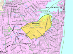
 Census Bureau map of Oceanport, New Jersey |
|
| Coordinates: 40°18′58″N 74°01′14″W / 40.316012°N 74.020479°WCoordinates: 40°18′58″N 74°01′14″W / 40.316012°N 74.020479°W | |
| Country |
|
| State |
|
| County | Monmouth |
| Incorporated | May 11, 1920 |
| Government | |
| • Type | Borough |
| • Body | Borough Council |
| • Mayor | John F. "Jay" Coffey, II (term ends December 31, 2019) |
| • Clerk | Jeanne Smith |
| Area | |
| • Total | 3.798 sq mi (9.838 km2) |
| • Land | 3.180 sq mi (8.237 km2) |
| • Water | 0.618 sq mi (1.600 km2) 16.27% |
| Area rank | 305th of 566 in state 21st of 53 in county |
| Elevation | 20 ft (6 m) |
| Population (2010 Census) | |
| • Total | 5,832 |
| • Estimate (2015) | 5,739 |
| • Rank | 353rd of 566 in state 30th of 53 in county |
| • Density | 1,833.7/sq mi (708.0/km2) |
| • Density rank | 303rd of 566 in state 37th of 53 in county |
| Time zone | Eastern (EST) (UTC-5) |
| • Summer (DST) | Eastern (EDT) (UTC-4) |
| ZIP code | 07757 |
| Area code(s) | 732 |
| FIPS code | 3402554570 |
| GNIS feature ID | 0885334 |
| Website | oceanportboro |
Oceanport is a borough in Monmouth County, New Jersey, United States. As of the 2010 United States Census, the borough's population was 5,832, reflecting an increase of 25 (+0.4%) from the 5,807 counted in the 2000 Census, which had in turn declined by 339 (-5.5%) from the 6,146 counted in the 1990 Census.
Oceanport was formed as a borough by an act of the New Jersey Legislature on April 6, 1920, from portions of Eatontown Township (now Eatontown), based on the results of a referendum held on May 11, 1920.
New Jersey Monthly magazine ranked Oceanport as its 4th best place to live in its 2008 rankings of the "Best Places To Live" in New Jersey.
According to the United States Census Bureau, the borough had a total area of 3.798 square miles (9.838 km2), including 3.180 square miles (8.237 km2) of land and 0.618 square miles (1.600 km2) of water (16.27%).
The borough borders the Monmouth County municipalities of Little Silver to the northwest, Long Branch to the east, Eatontown to the southwest and West Long Branch to the southeast. It shares a water border to the northeast with Monmouth Beach and forms a peninsula, jutting into the Shrewsbury River.
Unincorporated communities, localities and place names within the borough include Elkwood Park, Fort Monmouth, Gooseneck Point, Port-au-peck and Sands Point.
...
Wikipedia
