Oakland County, Michigan
| Oakland County, Michigan | ||
|---|---|---|
|
||
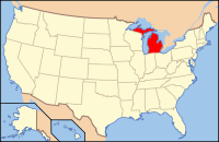
 Location in the U.S. state of Michigan |
||
 Michigan's location in the U.S. |
||
| Founded | January 12, 1819 (created) 1820 (organized) |
|
| Seat | Pontiac | |
| Largest city | Troy | |
| Area | ||
| • Total | 907 sq mi (2,349 km2) | |
| • Land | 868 sq mi (2,248 km2) | |
| • Water | 40 sq mi (104 km2), 4.4% | |
| Population (est.) | ||
| • (2015) | 1,242,304 | |
| • Density | 1,386/sq mi (535/km²) | |
| Congressional districts | 8th, 9th, 11th, 14th | |
| Time zone | Eastern: UTC-5/-4 | |
| Website | www |
|
Oakland County is a county located in the U.S. state of Michigan, located in the northwest of the Detroit metropolitan area. As of the 2010 census, its population was 1,202,362, making it the second-most populous county in Michigan, behind neighboring Wayne County. The county seat is Pontiac. The county was founded in 1819 and organized in 1820.
Oakland County is composed of 61 cities, townships and villages, and is part of the Detroit-Warren-Dearborn, MI Metropolitan Statistical Area. The city of Detroit is located in neighboring Wayne County, south of 8 Mile Road. Oakland County is among the ten highest income counties in the United States with populations over one million people. It is also home to Oakland University, a large public institution that straddles the Auburn Hills and Rochester Hills border.
The county's knowledge-based economic initiative, coined "Automation Alley", has developed one of the largest employment centers for engineering and related occupations in the United States. But Oakland County has shared in the recent economic hardships brought on by troubles at General Motors, Ford, and Chrysler. It has fared better than Detroit and Flint, as its economy is more diverse and less reliant on manufacturing jobs. All three automotive companies are major employers within southeast Michigan and have a significant presence within Oakland County.
...
Wikipedia

