Northern Circars
| Northern Circars ఉత్తర సర్కారులు |
|||||
| Division of British India | |||||
|
|||||
|
Flag |
|||||
| The Northern Circars shortly after their occupation by the British | |||||
| History | |||||
| • | The British buy the rights over the Circars | 1823 | |||
| • | Independence of India | 1947 | |||
| Area | 78,000 km2(30,116 sq mi) | ||||
Flag
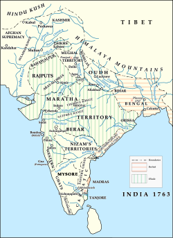
The Northern Circars (also spelt Sarkars) was a former division of British India's Madras Presidency. It consisted of a narrow slip of territory lying along the western side of the Bay of Bengal from 15° 40' to 20° 17' north latitude, in the present-day Indian states of Andhra Pradesh and Odisha.
The annexation by the British of the Northern Circars deprived Hyderabad State, the Nizam's dominion, of the considerable coastline it formerly had, assuming the shape it is now remembered for: that of a landlocked princely state with territories in Central Deccan, bounded on all sides by British India.
The territory derived its name from circar or sarkar, an Indian term applied to the component parts of a subah or province, each of which is administered by a deputy governor.
The Northern Circars were five in number: Chicacole, Rajahmundry, Ellore, Kondapalli and Guntur with a total area was about 30,000 square miles (78,000 km2).
...
Wikipedia


