North Platte River
| North Platte | |
| River | |
|
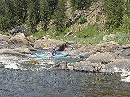
Canoers on the North Platte River near the Colorado - Wyoming border in Northgate Canyon
|
|
| Country | United States |
|---|---|
| States | Colorado, Wyoming, Nebraska |
| Tributaries | |
| - left | Sweetwater River |
| - right | Medicine Bow River, Laramie River |
| Cities | Walden, CO, Casper, WY, Laramie, WY, Scottsbluff, NE, Oshkosh, NE, North Platte, NE |
| Source | Confluence of Grizzly and Little Grizzly Creeks in Colorado |
| - location | Jackson County, Colorado |
| - elevation | 8,060 ft (2,457 m) |
| - coordinates | 40°33′01″N 106°23′35″W / 40.550331°N 106.392975°W |
| Mouth | Platte River |
| - location | Lincoln County, Nebraska |
| - elevation | 2,762 ft (842 m) |
| - coordinates | 41°06′56″N 100°41′15″W / 41.115573°N 100.687637°WCoordinates: 41°06′56″N 100°41′15″W / 41.115573°N 100.687637°W |
| Length | 716 mi (1,152 km) |
| Basin | 30,900 sq mi (80,031 km2) |
| Discharge | for Lisco, NE |
| - average | 1,355 cu ft/s (38 m3/s) |
| - max | 20,100 cu ft/s (569 m3/s) |
| - min | 63.1 cu ft/s (2 m3/s) |
|
|
|
|
|
|
|
|
|
|
|
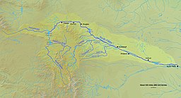
The North Platte River is a major tributary of the Platte River and is approximately 716 miles (1,152 km) long counting its many curves. It travels about 550 miles (890 km) distance. Its course lies in the U.S. states of Colorado, Wyoming, and Nebraska.
The head of the river is essentially all of Jackson County, Colorado, whose boundaries are the continental divide on the east and south and the mountain drainage peaks on the east—the north boundary is the state of Wyoming boundary. The rugged Rocky Mountains surrounding Jackson County have at least twelve peaks over 11,000 feet (3,400 m) in height. From Jackson County the river flows north about 200 miles (320 km) out of the Routt National Forest and North Park (Colorado basin) near what is now Walden, Colorado to Casper, Wyoming. Shortly after passing Casper the river turns to the east-southeast and flows about 350 miles (560 km) to the city of North Platte, Nebraska.
The North Plate and South Platte River join to form the Platte River in western Nebraska near the city of North Platte, Nebraska. The Platte River flows to the Missouri River which joins the Mississippi River to flow to the Gulf of Mexico. The river provides the major avenue of drainage for northern Colorado, eastern Wyoming and western Nebraska. It is only navigable over most of its length at high water by canoes, kayaks and rubber rafts.
...
Wikipedia


