North East Township, Erie County, Pennsylvania
| North East Township, Pennsylvania | |
|---|---|
| Township | |

State Line Methodist Church, located in Pennsylvania, as seen from New York
|
|
| Etymology: Its location in Erie County | |
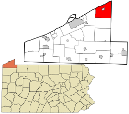
 Location in Erie County and the state of Pennsylvania |
|
| Country | United States |
| State | Pennsylvania |
| County | Erie |
| Area | |
| • Total | 42.4 sq mi (109.8 km2) |
| • Land | 42.2 sq mi (109.2 km2) |
| • Water | 0.2 sq mi (0.6 km2) |
| Population (2010) | |
| • Total | 6,315 |
| • Density | 150/sq mi (57.8/km2) |
| Time zone | EST (UTC-4) |
| • Summer (DST) | EDT (UTC-5) |
| Area code(s) | 814 |
| Website | northeasttwp |
North East Township is a township in Erie County, Pennsylvania, United States. The population was 6,315 at the 2010 census, down from 7,702 at the 2000 census.
The township is in the northeast corner of Erie County and is adjacent to the New York state line. Lake Erie borders the northern edge of the township. The township surrounds the borough of North East, a separate municipality. According to the United States Census Bureau, the township has a total area of 42.4 square miles (109.8 km2), of which 42.2 square miles (109.2 km2) is land and 0.23 square miles (0.6 km2), or 0.56%, is water.
North East Township contains Pennsylvania's northernmost point.
As of the census of 2000, there were 7,702 people, 2,485 households, and 1,861 families residing in the township. The population density was 181.8 people per square mile (70.2/km²). There were 2,691 housing units at an average density of 63.5/sq mi (24.5/km²). The racial makeup of the township was 97.83% White, 0.88% African American, 0.03% Native American, 0.43% Asian, 0.03% Pacific Islander, 0.25% from other races, and 0.56% from two or more races. Hispanic or Latino of any race were 0.82% of the population.
...
Wikipedia
