New Haven, VT
| New Haven, Vermont | |
|---|---|
| Town | |

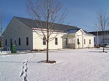
town offices and library
|
|
 Location in Addison County and the state of Vermont. |
|
| Coordinates: 44°6′31″N 73°10′15″W / 44.10861°N 73.17083°WCoordinates: 44°6′31″N 73°10′15″W / 44.10861°N 73.17083°W | |
| Country | United States |
| State | Vermont |
| County | Addison |
| Area | |
| • Total | 41.5 sq mi (107.6 km2) |
| • Land | 41.2 sq mi (106.7 km2) |
| • Water | 0.3 sq mi (0.9 km2) |
| Elevation | 341 ft (104 m) |
| Population (2010) | |
| • Total | 1,727 |
| • Density | 42/sq mi (16.2/km2) |
| Time zone | Eastern (EST) (UTC-5) |
| • Summer (DST) | EDT (UTC-4) |
| ZIP code | 05472 |
| Area code | 802 |
| FIPS code | 50-48700 |
| GNIS feature ID | 1462160 |
| Website | www |
New Haven is a town in Addison County, Vermont, United States. The population was 1,727 at the 2010 census. In addition to the town center, New Haven contains the communities of Belden (sometimes called Belden Falls), Brooksville, New Haven Junction and New Haven Mills.
New Haven is located in north-central Addison County, in the Champlain Valley. It is bordered by Ferrisburgh and Monkton to the north, Bristol to the east, Middlebury to the south, Weybridge to the southwest, and Waltham to the northwest. The town of Addison, west of Weybridge and Waltham, touches New Haven at one corner.
Otter Creek, one of the longest rivers in Vermont, forms part of the town's southwest border, with falls at Belden and Huntington Falls. The New Haven River, rising to the east in the Green Mountains, flows into Otter Creek at Brooksville.
U.S. Route 7 runs north-south through the town, connecting Vergennes and Middlebury. Vermont Route 17 crosses Route 7 at New Haven Junction and runs east into Bristol and west to Addison and the Crown Point Bridge over Lake Champlain into New York.
According to the United States Census Bureau, New Haven has a total area of 41.5 square miles (107.6 km2), of which 41.2 square miles (106.7 km2) is land and 0.35 square miles (0.9 km2), or 0.84%, is water.
As of the census of 2000, there were 1,666 people, 613 households, and 459 families residing in the town. The population density was 40.0 people per square mile (15.4/km2). There were 646 housing units at an average density of 15.5 per square mile (6.0/km2). The racial makeup of the town was 98.26% White, 0.24% African American, 0.60% Native American, and 0.90% from two or more races. Hispanic or Latino of any race were 0.84% of the population.
...
Wikipedia
