Negros Island
| Negros | ||||||||
|---|---|---|---|---|---|---|---|---|
| Region | ||||||||
| Negros Island Region (NIR) | ||||||||
From upper-left to lower-right: MassKara Festival, The Ruins, Balay Negrense, Mabinay Crystal Cave, Balinsasayao Twin Lakes Natural Park, Silliman University
|
||||||||
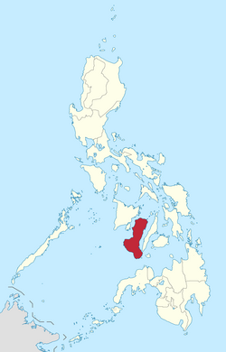
 Location in the Philippines |
||||||||
| Coordinates: 10°N 123°E / 10°N 123°ECoordinates: 10°N 123°E / 10°N 123°E | ||||||||
| Country | Philippines | |||||||
| Island Group | Visayas | |||||||
| Regional Center | Bacolod and Dumaguete¹ | |||||||
| Area | ||||||||
| • Total | 13,350.74 km2 (5,154.75 sq mi) | |||||||
| Population (2015) | ||||||||
| • Total | 4,414,131 | |||||||
| • Density | 330.63/km2 (856.3/sq mi) | |||||||
| Demonym(s) |
|
|||||||
| Divisions | ||||||||
| • Provinces | ||||||||
| • Highly urbanized city |
1
|
|||||||
| • Component cities | ||||||||
| • Municipalities | 38 | |||||||
| • Barangays | 1,219 | |||||||
| • Districts | 11 | |||||||
| Time zone | PST (UTC+8) | |||||||
| Spoken languages | ||||||||
|
||||||||

Mount Kanlaon, the highest peak in the island
|
|
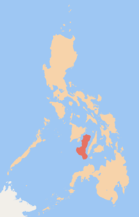
| Map of the Philippines showing Negros in red | |
| Geography | |
|---|---|
| Location | South East Asia |
| Archipelago | Visayas |
| Adjacent bodies of water | |
| Area | 13,309.6 km2 (5,138.9 sq mi) |
| Area rank | 62nd |
| Coastline | 644.9 km (400.72 mi) |
| Highest elevation | 2,465 m (8,087 ft) |
| Highest point | Kanlaon Volcano |
| Administration | |
| Region | Negros Island Region |
| Provinces | |
| Largest settlement | Bacolod (pop. 561,875) |
| Demographics | |
| Demonym | Negrense/Negrosanons |
| Population | 4,414,131 (2015) |
| Pop. density | 331.7 /km2 (859.1 /sq mi) |
| Ethnic groups | Visayans (Hiligaynons and Cebuanos) |
Negros is an island in the Philippines, which is the fourth largest in the country with a total land area of 13,309.60 square kilometres (5,138.87 sq mi). Negros is one of the islands that comprise the Visayas, which forms the central division of the country.
As an administrative region, it is officially named the Negros Island Region (Hiligaynon: Rehiyon sang Pulo sang Negros; Cebuano: Rehiyon sa Pulo sa Negros; Filipino: Rehiyon ng Pulo ng Negros) also abbreviated as NIR, the 18th and newest region of the Philippines, comprising the highly urbanized city of Bacolod and the provinces of Negros Occidental and Negros Oriental, along with its corresponding outlying islands and islets.
It was created by virtue of Executive Order No. 183 issued by President Benigno Aquino III on May 29, 2015. Inhabitants of the island region are mainly called Negrenses (locally Negrosanons). As of 2015, Negros Island Region's total population is 4,414,131.
Negros was originally called Buglas, an old Hiligaynon word thought to mean "cut off", as it is believed that the island was separated from a larger landmass by rising waters during the last ice age. Among its earliest inhabitants were the dark-skinned Ati people, one of several aboriginal Negrito ethnic groups dispersed throughout Asia that possesses a unique culture. The westernmost portions of the island soon fell under the rule of the Kedatuan of Madja-as from the neighbouring island of Panay.
...
Wikipedia


