Nartkala
| Nartkala (English) Нарткала (Russian) Нарткъалэ (Kabardian) |
|
|---|---|
| - Town - | |
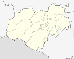
 Location of the Kabardino-Balkar Republic in Russia |
|
|
|
|
|
|
|
| Administrative status (as of November 2012) | |
| Country | Russia |
| Federal subject | Kabardino-Balkar Republic |
| Administrative district | Urvansky District |
| Administrative center of | Urvansky District |
| Municipal status (as of January 2011) | |
| Municipal district | Urvansky Municipal District |
| Urban settlement | Nartkala Urban Settlement |
| Administrative center of | Urvansky Municipal District, Nartkala Urban Settlement |
| Statistics | |
| Population (2010 Census) | 31,694 inhabitants |
| Time zone | MSK (UTC+03:00) |
| Founded | 1913 |
| Town status since | 1955 |
| Previous names | Dokshukino (until 1967) |
| on | |
Nartkala (Russian: Нарткала; Kabardian: Нарткъалэ) is a town and the administrative center of Urvansky District of the Kabardino-Balkar Republic, Russia, located 25 kilometers (16 mi) northeast of Nalchik. Population: 31,694 (2010 Census).
It was founded in 1913 as the railway station of Dokshukino (Докшукино); town status was granted to it in 1955. It was renamed Nartkala in 1967; the current name mean the city of the Narts (ancestors of various peoples of the Caucasus).
Within the framework of administrative divisions, Nartkala serves as the administrative center of Urvansky District, to which it is directly subordinated. As a municipal division, the town of Nartkala is incorporated within Urvansky Municipal District as Nartkala Urban Settlement.
Population: 31,694 (2010 Census);33,775 (2002 Census);28,171 (1989 Census).
As of the 2002 Census, the ethnic distribution of the population was:
...
Wikipedia

