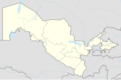
Namangan
|
Namangan Namangan/Наманган |
|
|---|---|
| City | |
| Location in Uzbekistan | |
| Coordinates: 41°00′04″N 71°40′06″E / 41.00111°N 71.66833°ECoordinates: 41°00′04″N 71°40′06″E / 41.00111°N 71.66833°E | |
| Country |
|
| Region | Namangan Region |
| Area | |
| • Total | 83,3 km2 (322 sq mi) |
| Elevation | 450 m (1,480 ft) |
| Population (2014) | |
| • Total | 475,700 |
| Postal code | 160100 |
| Area code(s) | +998 6922 |
Namangan (also in Uzbek: Наманган) is a city in eastern Uzbekistan. It is the administrative, economic, and cultural center of Namangan Region. Namangan is located in the northern edge of the Fergana Valley. The city is served by Namangan Airport.
Namangan has been an important craft and trade center in the Fergana Valley since the 17th century. A large number of factories were built in the city during Soviet times. During World War II, industrial production in Namangan increased fivefold compared with that of 1926-1927. Currently, Namangan is mainly a center for light industry, especially in food.
Namangan is Uzbekistan's second-largest city by population. The officially registered population of the city was 475,700 in 2014. Uzbeks are the largest ethnic group.
The city takes its name from the local salt mines (in Persian نمککان (namak kan) — "a salt mine").Babur mentioned the village of Namangan in his memoirs Baburnama. In his book A brief History of the Khanate of Kokand (Russian: Краткая история Кокандского ханства) (Kazan, 1886), the Russian ethnographer Vladimir Petrovich Nalivkin wrote that Namangan is mentioned in legal documents dating back to 1643.
Politically, Namangan became a part of the Uyghur Empire of the Karakhanid State and was known to have been a settlement in the 15th century. The residents of the ancient city of Akhsikat, which was severely damaged by an earthquake, moved to the then-village of Namangan in 1610. Namangan became a city afterward. On the eve of the Russian invasion in 1867, the town had been a part of the Khanate of Kokand since the middle of the 18th century.
...
Wikipedia

