Nadym
| Nadym (English) Надым (Russian) |
|
|---|---|
| - Town - | |
 In Nadym |
|
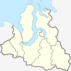
 Location of Yamalo-Nenets Autonomous Okrug in Russia |
|
|
|
|
|
|
|
|
|
|
| Administrative status (as of September 2009) | |
| Country | Russia |
| Federal subject | Yamalo-Nenets Autonomous Okrug |
| Administratively subordinated to | town of okrug significance of Nadym |
| Administrative center of | Nadymsky District, town of okrug significance of Nadym |
| Municipal status (as of October 2012) | |
| Municipal district | Nadymsky Municipal District |
| Urban settlement | Nadym Urban Settlement |
| Administrative center of | Nadymsky Municipal District, Nadym Urban Settlement |
| Mayor | Leonid Dyachenko |
| Statistics | |
| Population (2010 Census) | 46,611 inhabitants |
| Time zone | YEKT (UTC+05:00) |
| Established | 1598 (first mentioned), 1968 (re-established) |
| Town status since | March 9, 1972 |
| Postal code(s) | 629730 |
| Dialing code(s) | +7 3499 |
|
|
|
| on | |
Nadym (Russian: Нады́м) is a town in Yamalo-Nenets Autonomous Okrug, Russia, located on the Nadym River. Population: 46,611 (2010 Census);45,943 (2002 Census);52,586 (1989 Census).
The origin of the town's name is unknown. One of the most likely versions is that it derives from the Nenets word nyaidem, which translates into English as "mossy place".
The first mention of the city's name appears at the end of the 16th century. The name "Nadym" appears on Russian maps from the end of the 17th century, and the river Nadym was noted in published form at the turn of the 17th and 18th Centuries in the "Drawing Book of Siberia" by Russian geographer, cartographer and topographer, Semyon Remezov and sons, composed in 1699 — 1701. On the map of Tobolsk province of 1802, Nadym was already marked as having significant population. Today it's located 32 kilometers from the mouth of the river Nadym, referred to as Nadym mound.
In 1929, a reindeer farm called "Nadym" was founded on the right bank of the river Nadym. However, in 1934 the farm was disbanded and turned into a factory.
In the fall of 1967, it was chosen as the reference framework for the development of a regional gas bearing deposit. Surrounded by numerous lakes, the village situated on an elevated dry place was chosen for a runway for the airline industry. Relatively small, 12 kilometers away from the river Nadym, for which it was named, by the 1950s - 1960s, the village began to be called "New Nadym".
In parallel to its accelerated pace of development, the gas company created Bear City, with the intention of becoming a social and cultural center of the Tyumen North. In August 1971, Nadym held a groundbreaking ceremony for its first major building and on March 9, 1972 by decree of the Soviet First Secretary the industrial community Nadym was incorporated within the Nadymsky Municipal District as Nadym Urban Settlement.
The main enterprise of the town is Nadymgazprom, a subsidiary of "Gazprom dobycha Nadym" (General Director Sergey Menshikov) which accounts for about 11% of gas produced in Russia. Also, the city contains the largest of the independent gas producers "NOVATEK" (Yurkharovskoye field).
...
Wikipedia


