Mustang Ridge
| Mustang Ridge, Texas | |
|---|---|
| City | |
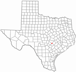
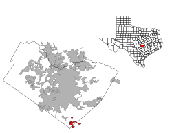
 Location of Mustang Ridge, Texas |
|
 |
|
| Coordinates: 30°2′53″N 97°41′26″W / 30.04806°N 97.69056°WCoordinates: 30°2′53″N 97°41′26″W / 30.04806°N 97.69056°W | |
| Country | United States |
| State | Texas |
| Counties | Travis, Caldwell, Bastrop |
| Area | |
| • Total | 3.8 sq mi (9.8 km2) |
| • Land | 3.8 sq mi (9.8 km2) |
| • Water | 0.0 sq mi (0.0 km2) |
| Elevation | 623 ft (190 m) |
| Population (2010) | |
| • Total | 861 |
| • Density | 230/sq mi (88/km2) |
| Time zone | Central (CST) (UTC-6) |
| • Summer (DST) | CDT (UTC-5) |
| Zip Code | 78610 |
| FIPS code | 48-50200 |
| GNIS feature ID | 1699806 |
Mustang Ridge is a city in Caldwell, Bastrop, and Travis Counties in the U.S. state of Texas. The population was 861 at the 2010 census.
Mustang Ridge is located at 30°02′53″N 97°41′26″W / 30.048123°N 97.690583°W (30.048123, -97.690583).
According to the United States Census Bureau, the city has a total area of 3.8 square miles (9.8 km2), all land.
Mustang Ridge was incorporated into a city by Alton Brooks Laws Jr and Charles Laws in 1985 [1]. Alton Brooks Laws was elected the first mayor, municipal judge, and state magistrate [2]. Charles Laws became a source of public controversy when he referred to a proposed detention facility as "a holding pen for wetbacks" on a public agenda.
As of the census of 2000, 785 people, 256 households, and 214 families resided in the city. The population density was 206.9 people per square mile (80.0/km2). The 274 housing units averaged 72.2/sq mi (27.9/km2). The racial makeup of the city was 67.52% White, 4.08% African American, 2.80% Native American, 0.38% Asian, 22.93% from other races, and 2.29% from two or more races. Hispanics or Latinos of any race were 48.41% of the population.
...
Wikipedia
