Mundi
|
Mundi (Moondi) मून्दी, मूँदी, मुन्दी, मूंदी |
|
|---|---|
| City | |
| Nickname(s): Moondi | |
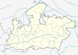
| Location of Mundi | |
| Coordinates: 22°04′N 76°30′E / 22.07°N 76.5°ECoordinates: 22°04′N 76°30′E / 22.07°N 76.5°E | |
| Country |
|
| State | Madhya Pradesh |
| Region | Nimar |
| District | Khandwa District |
| Named for | Mundari(Ring) |
| Government | |
| • Body | Nagar Parishad |
| • President |
Santosh Rathore(2014-2019) Asha Jain(2009-2014) Lakshaman Patel (2004-2009) Santosh Rathore (1999-2004) (Bharatiya Janata Party(Bjp)) |
| • M.L.A | Lokendra Singh Tomar (Mandhata-Mundi Kshetra) Lokendra Singh Tomar Rajnarayan Singh Purni |
| Population (2011) | |
| • Total | 30,000 |
| Demonym(s) | Mundian's , Mundari |
| Time zone | IST (UTC+5:30) |
| Vehicle registration | MP-12 (Khandwa R.T.O) |
| Spoken Languages | Hindi, English |
| Literacy | 75% |
| Pin Code | 450112 |
| Telephone Code | +91-07326 |
Mundi is a City under Khandwa district in the Indian state of Madhya Pradesh. It is a thousand years old town. It is surrounded by significant forest area which belongs to Narmada River Valley. It is 120 km from Indore, the commercial capital of the state.
As of 2012[update] India census, Mundi had a population of 30,000. Males constitute 52% of the population and females 48%. Mundi has an average literacy rate of 72%, higher than the national average of 59.5%: male literacy is 70%, and female literacy is 52%. In Mundi, 15% of the population is under 6 years of age.
"Mundi" is located at 22°04′N 76°30′E / 22.07°N 76.5°E. It has an average elevation of 300 metres (1000 feet)."Mundi" is located on the Main Road's & Highway's, with daily connections to Khandwa, Indore, Bhopal, Dewas etc.
The name of the city is derived from "Mundari" (meaning ring or circle shape). During the rise of Buddhism, the East Nimar region was included in the Avanti Kingdom under Chand Pradyota Mahesana, which was later added to the growing empire of Magadha by Shishunaga. From the early 2nd century BC to the late 15th century AD, the Nimar Region (earlier a part of Khandesh) was ruled by many emperors from many dynasties, which include Mauryas, Shungas, Satvahanas, Kardamakas, Abhiras, Vakatakas, Imperial Guptas, Kalchuris, Vardhanas (of Harsha Vardhana fame), Chalukyas, Kanungos, Rashtrakutas, Paramaras, Faruki etc. A Well is situated at ‘’’Koteshwer’’’ or ‘’’Loteshwer’’’, created by Pandhawas. ‘’’Renuka Dham’’’ is another ancient temple. Since the mid-16th century to the early 18th century, the Nimar region, was under the rule of Aurangzeb, Bahadur Shah, Peshwas, Sindhia, Bawaniya, Holkar, Pawar, (Marathas), Pindaris etc. Later from early part of the mid-18th century, the management of the Nimar region came under the British.
...
Wikipedia

