Mount Vernon, Illinois
| Mount Vernon | |
| Mt. Vernon | |
| City | |
|
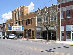
Town Center of Mount Vernon
|
|
| Motto: Mt. Vernon, City of Opportunity. | |
| Nickname: The King City | |
| Country | United States |
|---|---|
| State | Illinois |
| County | Jefferson |
| Townships | Mount Vernon, Shiloh, Dodds, McClellan |
| Coordinates | 38°18′49″N 88°54′29″W / 38.31361°N 88.90806°WCoordinates: 38°18′49″N 88°54′29″W / 38.31361°N 88.90806°W |
| Area | 13.15 sq mi (34 km2) |
| - land | 13.07 sq mi (34 km2) |
| - water | 0.08 sq mi (0 km2) |
| Population | 15,277 (2010) |
| Density | 1,412.1/sq mi (545/km2) |
| Founded | 1817 |
| Mayor | Mary Jane Chesley |
| Timezone | CST (UTC−6) |
| - summer (DST) | CDT (UTC−5) |
| Postal code | 62864 |
| Area code | 618 |
| Website: http://mtvernon.com | |
Mount Vernon known as "The King City" is a city in and the county seat of Jefferson County, Illinois, United States. The population was 15,277 at the 2010 census.
Mount Vernon is the principal city of the Mount Vernon Micropolitan Statistical Area, which includes all of Jefferson and Hamilton counties.
Mt. Vernon was founded in 1817 by Zadok Casey, who was elected to the State Senate in 1822 and was elected Lieutenant Governor in 1833. He served in the U.S. Congress between 1833 and 1843. The town was named for George Washington's plantation, Mount Vernon, which was named for Edward Vernon, a British naval hero.
When the town was founded, there was no road to it. Travelers had to get there by either following the high ground from the north or crossing the swamps from the south. In the early 19th century the Goshen Road crossed Illinois in a northwesterly direction from Old Shawneetown, Illinois to the Goshen Settlement, near what is now Edwardsville. This road was the main road in Illinois. When Mt. Vernon was first settled, the Goshen Road made a wide arc across Jefferson County, crossing Casey Creek and the Big Muddy north of Mt. Vernon, avoiding the swamps to the south, but bypassing Mt. Vernon. The road entered the county at its southeast corner. It passed through, or near, what are now Opdyke, East Salem, Idlewood, Dix and Walnut Hill. However, it was apparent to the early settlers that the town would fail without roads. In 1820–1821, Ben Hood and Carter Wilkey built a bridge over Casey Creek, to the southeast of town. This bridge was near the present bridge on Illinois Route 142. A road was built from there northwest, over ground that is now impassable, toward the old cemetery behind the modern Bethel Cemetery. Deep cuts through the old cemetery attest to the location of the road. From there the road probably followed modern Route 37 into town, somewhere shifting from 10th Street on west to 12th Street.
...
Wikipedia


