Walnut Hill, Illinois
| Walnut Hill | |
| Village | |
| Country | United States |
|---|---|
| State | Illinois |
| County | Marion |
| Coordinates | 38°28′39″N 89°2′44″W / 38.47750°N 89.04556°WCoordinates: 38°28′39″N 89°2′44″W / 38.47750°N 89.04556°W |
| Area | 0.37 sq mi (1 km2) |
| - land | 0.37 sq mi (1 km2) |
| - water | 0.00 sq mi (0 km2) |
| Population | 109 (2000) |
| Density | 294.2/sq mi (114/km2) |
| Timezone | CST (UTC-6) |
| - summer (DST) | CDT (UTC-5) |
| Postal code | 62893 |
| Area code | 618 |
|
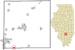
Location in Marion County and the state of Illinois.
|
|
|
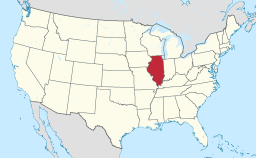
Location of Illinois in the United States
|
|
Walnut Hill is a village in Marion County, Illinois, United States. The population was 109 at the 2000 census.
Walnut Hill was at one time the intersection of two of the main roads in Illinois: the George Rogers Clark Trace, and the Yadda Road.
The original capital of Illinois was at Kaskaskia. The overland route from Kaskaskia to the interior of the State followed the Kaskaskia/Big Muddy divide, which went through Walnut Hill. George Rogers Clark marched through Walnut Hill in February, 1779 in his march from Fort Kaskaskia to Fort Vincennes, which resulted in the conquest of Illinois by the army of Virginia.
Traces of the Kaskaskia/Vincennes road can be seen in several short stretches of road in northwestern Jefferson County, which point toward Walnut Hill, ignoring the surveyed Section boundaries. Northeast of Walnut Hill, the Kell Road is a winding, pioneer road up to its intersection with Interstate 57, from which it follows the modern Section lines to Kell.
Walnut Hill was also on the Goshen Road, an early road across Illinois, from Shawneetown to the Goshen Settlement near Glen Carbon. Remnants of the Goshen Road can be seen in short segments of pioneer road between Dix and Walnut Hill. It is possible that construction of the railroad tracks from Dix to Walnut Hill obliterated much of the original Goshen road.
In 1823, Thomas D. Minor built a road from Mt. Vernon to Walnut Hill. This was called the "Vandalia Road", in that it connected with roads to the new State capital in Vandalia. The new road joined the Goshen Road just south of Walnut Hill. Today it is called the "Old Centralia Road". The new road eventually captured much of the traffic on the Goshen Road, since it provided a shorter route across Jefferson County.
The modern road running northwest out of Walnut Hill toward Centralia is the same as the Goshen Road as shown on the original survey maps of Illinois.
...
Wikipedia


