Mount Stromlo
| Mount Stromlo | |
|---|---|

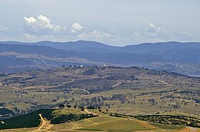
Mount Stromlo, as viewed from the Telstra Tower.
|
|
| Highest point | |
| Elevation | 770 m (2,530 ft) |
| Coordinates | 35°19′S 149°01′E / 35.317°S 149.017°ECoordinates: 35°19′S 149°01′E / 35.317°S 149.017°E |
| Geography | |
|
Location of Mount Stromlo in the ACT
|
|
| Location | Australian Capital Territory, Australia |
| Geology | |
| Volcanic arc/belt | Laidlaw Volcanics |
| Last eruption | Silurian period |
Mount Stromlo (formerly Mount Strom) is a mountain with an elevation of 770 metres (2,530 ft) AHD that is situated in the Weston Creek district of Canberra, in the Australian Capital Territory, Australia. The mountain is most notable as the location of the Mount Stromlo Observatory. The mountain forms part of the catchment area of the Cotter River which in turn is the primary water supply for Canberra.
The rock on Mount Stromlo consists of ignimbrite from the Laidlaw Volcanics. This erupted in the upper Silurian period over the top of the Deakin Volcanics rhyodacite which is visible on the surface on the lower slopes in the east and southeast sides. The northern lower slopes are covered with a calcareous shale which is included in the Laidlaw Volcanics as it was deposited at the same time. This is cut off on the northwest side by the Winslade Fault, which heads north east to Cook and Kaleen. A spur fault heads off east from the Winslade Fault to under the Scrivener Dam. On the northwest and north side of these faults are middle Silurian period rhyodacite volcanic deposits from the Walker Volcanics. The northern side was uplifted compared with the southern side.
Stoney Creek and its tributaries drain the north side of the mountain, The east side drains into the Molonglo River. The south side supplies Blugar Creek that runs into the Murrumbidgee River.
The summit of the mountain where the telescopes are located is elongated in a north-south direction, with a spur running to the southwest where the water treatment plant is situated.
...
Wikipedia

